Earthquake NORTH ISLAND OF NEW ZEALAND
Fri, 07 Dec 2012 18:19:09 GMT
Time13 years ago
Location
-38.6500, 175.9400
Depth
189.0 KM
Event Summary
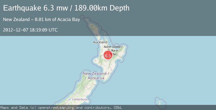
A 6.3 magnitude earthquake struck on NORTH ISLAND OF NEW ZEALAND, at Fri, 07 Dec 2012 18:19:09 GMT. Depth: 189km. Reviewed by EMSC seismologists, this strong quake occurred at a magnitude type of mw.
Magnitude
6.3
mw
Source
EMSC
Intensity
-
Agency Reports
1 Sources| Source | Magnitude | Depth | Time |
|---|---|---|---|
| EMSCPrimary | 6.3 | 189 km | 13 years ago |
Earthquake Details
AutomaticEvent IDemsc_EMSC_20121207_0000076
Tsunami PotentialNo
Magnitude Typemw
Nearest Places
- Whangamata Stream1.7 km
- Whangamata Stream2.6 km
- Okaia Stream2.6 km
- Kinloch2.7 km
- Okaia Stream3.0 km
Comments
Join the discussion about this event.
Latest Earthquakes
2.5Mag
Central Alaska
Time6 minutes ago
Depth0.00 km
SourceVYT (Automatic)
1.5Mag
42 km SSW of Cantwell, Alaska
Time8 minutes ago
Depth5.10 km
SourceUSGS (Automatic)
2.3Mag
northwestern Russia
Time12 minutes ago
Depth0.00 km
SourceVYT (Automatic)
1.1Mag
7 km WSW of Corona, CA
Time12 minutes ago
Depth22.23 km
SourceUSGS (Automatic)
1.6Mag
60 km S of Whites City, New Mexico
Time13 minutes ago
Depth4.19 km
SourceUSGS (Automatic)
Nearby Earthquakes
3.0Mag
NORTH ISLAND OF NEW ZEALAND
Time4 years ago
Depth150.00 km
SourceGNS (Automatic)
3.0Mag
NORTH ISLAND OF NEW ZEALAND
Time1 year ago
Depth165.60 km
SourceGNS (Automatic)
3.0Mag
NORTH ISLAND OF NEW ZEALAND
Time2 years ago
Depth177.00 km
SourceGNS (Automatic)
3.0Mag
NORTH ISLAND OF NEW ZEALAND
Time3 years ago
Depth9.00 km
SourceGNS (Automatic)
5.6Mag
NORTH ISLAND OF NEW ZEALAND
Time15 years ago
Depth146.00 km
SourceEMSC (Automatic)