Earthquake KERMADEC ISLANDS REGION
Wed, 28 Aug 2013 02:54:41 GMT
Time12 years ago
Location
-27.8900, 179.7900
Depth
492.0 KM
Event Summary
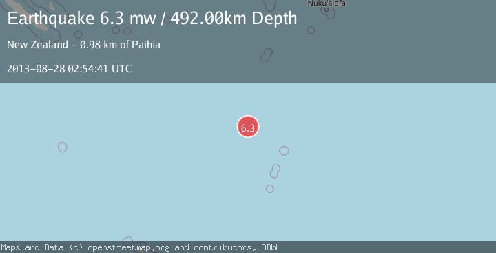
A 6.3 magnitude earthquake struck on KERMADEC ISLANDS REGION, at Wed, 28 Aug 2013 02:54:41 GMT. Depth: 492km. Reviewed by EMSC seismologists, this strong quake occurred at a magnitude type of mw.
Magnitude
6.3
mw
Source
EMSC
Intensity
I
Agency Reports
1 Sources| Source | Magnitude | Depth | Time |
|---|---|---|---|
| EMSCPrimary | 6.3 | 492 km | 12 years ago |
Earthquake Details
AutomaticEvent IDemsc_EMSC_20130828_0000009
QualityS
Tsunami PotentialNo
Magnitude Typemw
Last Update5 months ago
Nearest Places
Possibly felt by: 159.7K
- 896.9 km2.1K people
- 901.0 km1.2K people
- 901.8 km3K people
- 903.5 km3.4K people
- 905.4 km3K people
- 905.6 km22.4K people
- 906.6 km8K people
- 913.6 km1.1K people
- 982.8 km1.7K people
- IOpua984.7 km1.3K people
- 985.4 km8.1K people
- 991.5 km1.7K people
- 993.4 km1.6K people
- 993.7 km1.4K people
- 995.1 km1.9K people
- 996.9 km2.8K people
- 1009.1 km7.7K people
- 1009.5 km2.3K people
- 1012.7 km1.4K people
- 1013.0 km50.9K people
- 1013.4 km
- 1013.5 km2.5K people
- 1014.2 km6.9K people
- 1015.1 km5.8K people
- 1020.7 km1K people
- 1023.8 km2.9K people
- 1024.1 km1.1K people
- 1025.0 km1.2K people
- 1030.9 km1.2K people
- 1034.3 km1.8K people
- 1043.9 km3.5K people
- 1045.9 km1.3K people
- 1053.4 km5.1K people
- 1053.4 km1.5K people
- 1056.8 km2.3K people
- 1060.2 km3.9K people
- 1061.7 km6.6K people
- 1064.7 km2.4K people
- 1065.4 km1.9K people
- 1065.8 km6.3K people
- 1077.0 km1.7K people
- 1078.9 km12.3K people
- 1079.2 km1.2K people
- 1079.8 km1.6K people
- 1082.7 km2.5K people
- 1082.9 km
- 1084.6 km2K people
- 1085.1 km1.4K people
- 1086.0 km2K people
- 1088.5 km6.3K people
- 1088.6 km1.4K people
- 1089.9 km2.5K people
- 1090.1 km10.6K people
- 1090.5 km4.9K people
- 1090.7 km3K people
- 1091.4 km10.8K people
- 1091.9 km2.9K people
- 1093.4 km8.4K people
- ISuva1093.4 km77.4K people
- 1094.1 km5.1K people
- 1094.2 km10.4K people
- 1095.7 km8.9K people
- 1096.0 km1.2K people
- 1096.1 km7.6K people
- 1096.4 km4.3K people
- 1096.9 km2.9K people
- 1097.1 km4.3K people
- 1097.2 km11.2K people
- 1097.3 km8.8K people
- 1097.4 km9.3K people
- 1097.6 km207.9K people
- 1097.7 km3.4K people
- 1098.1 km3.2K people
- 1098.3 km4.5K people
- 1098.4 km2.2K people
- 1098.6 km9.3K people
- 1098.7 km4.2K people
- 1098.8 km3.7K people
- 1099.2 km9.3K people
- 1099.3 km10.8K people
- 1099.3 km8.1K people
- 1099.6 km11.1K people
- 1099.6 km92K people
- 1099.7 km11.7K people
- 1099.8 km4.5K people
- 1099.8 km4.6K people
- 1099.9 km4.3K people
- 1100.0 km5K people
- 1100.6 km2.9K people
- 1100.8 km6.3K people
- 1101.0 km3.5K people
- 1101.2 km2.6K people
- 1101.2 km4K people
- 1101.4 km4.7K people
- 1101.5 km5.3K people
- 1101.6 km5.7K people
- 1101.8 km2.1K people
- 1101.8 km5.6K people
- 1101.9 km417.9K people
- 1102.0 km4.8K people
- 1102.2 km7.1K people
- 1102.4 km3K people
- 1102.5 km7.1K people
- 1102.8 km4.4K people
- 1102.9 km7.3K people
- 1103.0 km1.7K people
- 1103.2 km9.8K people
- 1103.2 km5.7K people
- 1103.4 km1.6K people
- 1103.5 km3.9K people
- 1103.7 km23.6K people
- 1103.8 km4.7K people
- 1104.3 km2.3K people
- 1104.6 km11.7K people
- 1105.0 km9.9K people
- 1105.1 km11.7K people
- 1105.2 km4.1K people
- 1105.2 km3.5K people
- 1105.5 km19.8K people
- 1105.6 km14.3K people
- 1105.7 km20.1K people
- 1105.7 km8.7K people
- 1105.9 km1.5K people
- 1106.7 km3.3K people
- 1106.7 km10.4K people
- 1107.1 km20.1K people
- 1107.1 km12.6K people
- 1107.3 km3.8K people
- 1107.3 km3.4K people
- 1107.5 km5.8K people
- 1107.6 km24.3K people
- 1107.8 km17.7K people
- 1107.8 km3.7K people
- 1107.9 km21.4K people
- 1107.9 km5.8K people
- 1108.2 km16.4K people
- 1108.3 km4.6K people
- 1108.6 km17.6K people
- 1108.6 km11K people
- 1108.8 km11.2K people
- 1109.3 km13.3K people
- 1109.3 km8.2K people
- 1110.7 km22.3K people
- 1110.8 km49.1K people
- 1110.8 km8.2K people
- 1111.0 km5.8K people
- 1111.0 km10.9K people
- 1111.0 km9.4K people
- 1111.0 km2K people
- 1111.2 km29.7K people
- 1111.2 km8.1K people
- 1111.3 km16.8K people
- 1111.5 km8.5K people
- 1111.7 km362K people
- 1112.0 km4.6K people
- 1112.4 km24.1K people
- IWiri1113.0 km5.4K people
- 1113.0 km2.9K people
- 1113.6 km4.9K people
- 1113.9 km14.9K people
- 1114.2 km21.6K people
- 1114.3 km1.4K people
- 1114.5 km2.2K people
- 1114.7 km3.6K people
- 1114.8 km2.6K people
- 1115.0 km7.5K people
- 1115.8 km8.5K people
- 1116.1 km2.8K people
- 1116.4 km20.6K people
- 1116.5 km27.7K people
- 1117.1 km2.8K people
- 1117.4 km3.3K people
- 1117.5 km1.1K people
- 1117.5 km2.2K people
- 1118.4 km4.6K people
- 1118.8 km1.2K people
- 1119.7 km1.6K people
- 1121.9 km4K people
- 1124.6 km1.8K people
- 1124.8 km2.3K people
- 1129.8 km21.4K people
Felt Reports0
Did you feel this earthquake? Report it to help others.
No reports yet
Be the first to report this earthquake!
Latest Earthquakes
Loading...
Nearby Earthquakes
4.2Mag
KERMADEC ISLANDS REGION
Time3 months ago
Depth420.70 km
SourceNEIC (Automatic)
4.0Mag
KERMADEC ISLANDS REGION
Time2 years ago
Depth336.70 km
SourceGNS (Automatic)
4.0Mag
KERMADEC ISLANDS REGION
Time2 years ago
Depth316.60 km
SourceGNS (Automatic)
5.1Mag
KERMADEC ISLANDS REGION
Time3 years ago
Depth519.00 km
SourceEMSC (Automatic)
4.0Mag
KERMADEC ISLANDS REGION
Time5 years ago
Depth500.00 km
SourceGNS (Automatic)