Earthquake STRAIT OF GIBRALTAR
Mon, 16 Dec 2013 07:06:20 GMT
Time12 years ago
Location
35.5000, -6.9600
Depth
30.0 KM
Event Summary
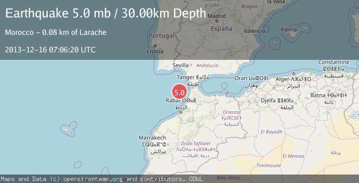
A 5.0 magnitude earthquake struck on STRAIT OF GIBRALTAR, at Mon, 16 Dec 2013 07:06:20 GMT. Depth: 30km. Reviewed by EMSC seismologists, this moderate quake occurred at a magnitude type of mb.
Magnitude
5.0
mb
Source
EMSC
Intensity
-
Agency Reports
1 Sources| Source | Magnitude | Depth | Time |
|---|---|---|---|
| EMSCPrimary | 5.0 | 30 km | 12 years ago |
Earthquake Details
AutomaticEvent IDemsc_EMSC_20131216_0000017
Tsunami PotentialNo
Magnitude Typemb
Nearest Places
- Yuma Hill15.7 km
- Ginsburg Hill18.0 km
- Punta Nador79.5 km
- Punta Nador Lighthouse79.5 km
- Hay Nador79.7 km
Comments
Join the discussion about this event.
Latest Earthquakes
1.8Mag
Tarapaca, Chile
Time47 seconds ago
Depth106.45 km
SourceVYT (Automatic)
2.2Mag
Tarapaca, Chile
Time6 minutes ago
Depth111.94 km
SourceVYT (Automatic)
1.9Mag
Central Alaska
Time7 minutes ago
Depth32.10 km
SourceVYT (Automatic)
3.4Mag
HAWAII REGION, HAWAII
Time7 minutes ago
Depth4.70 km
SourceHV (Automatic)
1.9Mag
STRAIT OF GIBRALTAR
Time11 minutes ago
Depth0.00 km
SourceIGN (Automatic)
Nearby Earthquakes
3.0Mag
STRAIT OF GIBRALTAR
Time4 years ago
Depth24.00 km
SourceMDD (Automatic)
3.0Mag
STRAIT OF GIBRALTAR
Time4 years ago
Depth32.00 km
SourceMDD (Automatic)
3.0Mag
STRAIT OF GIBRALTAR
Time1 year ago
Depth30.00 km
SourceEMSC (Automatic)
3.0Mag
STRAIT OF GIBRALTAR
Time16 years ago
Depth18.00 km
SourceEMSC (Automatic)
3.0Mag
STRAIT OF GIBRALTAR
Time19 years ago
Depth39.00 km
SourceMDD (Automatic)