Earthquake SOUTH OF KERMADEC ISLANDS
Sun, 02 Feb 2014 09:26:33 GMT
Time12 years ago
Location
-32.9300, -177.8000
Depth
10.0 KM
Event Summary
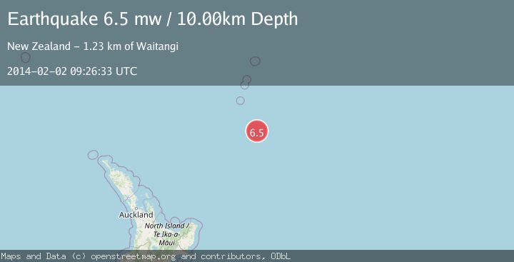
A 6.5 magnitude earthquake struck on SOUTH OF KERMADEC ISLANDS, at Sun, 02 Feb 2014 09:26:33 GMT. Depth: 10km. Reviewed by EMSC seismologists, this strong quake occurred at a magnitude type of mw.
Magnitude
6.5
mw
Source
EMSC
Intensity
-
Agency Reports
1 Sources| Source | Magnitude | Depth | Time |
|---|---|---|---|
| EMSCPrimary | 6.5 | 10 km | 12 years ago |
Earthquake Details
AutomaticEvent IDemsc_EMSC_20140202_0000044
Tsunami PotentialNo
Magnitude Typemw
Nearest Places
- 113.5 km
- 128.0 km
- 134.4 km
- 147.6 km
- 171.0 km
Comments
Join the discussion about this event.
Latest Earthquakes
2.5Mag
Poland
Time1 minute ago
Depth7.57 km
SourceVYT (Automatic)
3.7Mag
ANTOFAGASTA, CHILE
Time5 minutes ago
Depth83.60 km
SourceCSN (Automatic)
4.8Mag
Antofagasta, Chile
Time5 minutes ago
Depth189.82 km
SourceVYT (Automatic)
0.8Mag
Fox Islands, Aleutian Islands, Alaska
Time5 minutes ago
Depth0.00 km
SourceVYT (Automatic)
2.7Mag
Antofagasta, Chile
Time14 minutes ago
Depth205.69 km
SourceVYT (Automatic)
Nearby Earthquakes
6.3Mag
SOUTH OF KERMADEC ISLANDS
Time10 years ago
Depth25.00 km
SourceEMSC (Automatic)
5.9Mag
SOUTH OF KERMADEC ISLANDS
Time10 years ago
Depth10.00 km
SourceEMSC (Automatic)
5.2Mag
SOUTH OF KERMADEC ISLANDS
Time9 years ago
Depth10.00 km
SourceEMSC (Automatic)
5.8Mag
SOUTH OF KERMADEC ISLANDS
Time10 years ago
Depth10.00 km
SourceEMSC (Automatic)
5.5Mag
SOUTH OF KERMADEC ISLANDS
Time9 years ago
Depth10.00 km
SourceEMSC (Automatic)