Earthquake SAMOA ISLANDS REGION
Mon, 14 Mar 2016 15:39:30 GMT
Time9 years ago
Location
-16.1700, -172.8800
Depth
10.0 KM
Event Summary
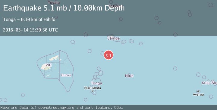
A 5.1 magnitude earthquake struck on SAMOA ISLANDS REGION, at Mon, 14 Mar 2016 15:39:30 GMT. Depth: 10km. Reviewed by EMSC seismologists, this moderate quake occurred at a magnitude type of mb.
Magnitude
5.1
mb
Source
EMSC
Intensity
-
Agency Reports
1 Sources| Source | Magnitude | Depth | Time |
|---|---|---|---|
| EMSCPrimary | 5.1 | 10 km | 9 years ago |
Earthquake Details
AutomaticEvent IDemsc_EMSC_20160314_0000062
Tsunami PotentialNo
Magnitude Typemb
Nearest Places
- 93.1 km
- 94.0 km
- 94.8 km
- 94.8 km
- 95.2 km
Comments
Join the discussion about this event.
Latest Earthquakes
2.6Mag
Atacama, Chile
Time8 minutes ago
Depth10.13 km
SourceVYT (Automatic)
1.6Mag
Greater Los Angeles area, California
Time9 minutes ago
Depth16.60 km
SourceVYT (Automatic)
1.6Mag
Kenai Peninsula, Alaska
Time12 minutes ago
Depth3.17 km
SourceVYT (Automatic)
3.1Mag
Papua region, Indonesia
Time12 minutes ago
Depth56.88 km
SourceVYT (Automatic)
1.2Mag
WESTERN TURKEY
Time17 minutes ago
Depth4.10 km
SourceAFAD (Automatic)
Nearby Earthquakes
5.0Mag
SAMOA ISLANDS REGION
Time11 years ago
Depth2.00 km
SourceEMSC (Automatic)
5.1Mag
SAMOA ISLANDS REGION
Time3 years ago
Depth10.00 km
SourceEMSC (Automatic)
5.3Mag
SAMOA ISLANDS REGION
Time18 years ago
Depth35.00 km
SourceEMSC (Automatic)
5.8Mag
SAMOA ISLANDS REGION
Time16 years ago
Depth2.00 km
SourceEMSC (Automatic)
5.2Mag
SAMOA ISLANDS REGION
Time5 years ago
Depth30.00 km
SourceEMSC (Automatic)