Earthquake KEPULAUAN BABAR, INDONESIA
Mon, 18 Jul 2016 05:32:01 GMT
Time9 years ago
Location
-8.2600, 129.3700
Depth
40.0 KM
Event Summary
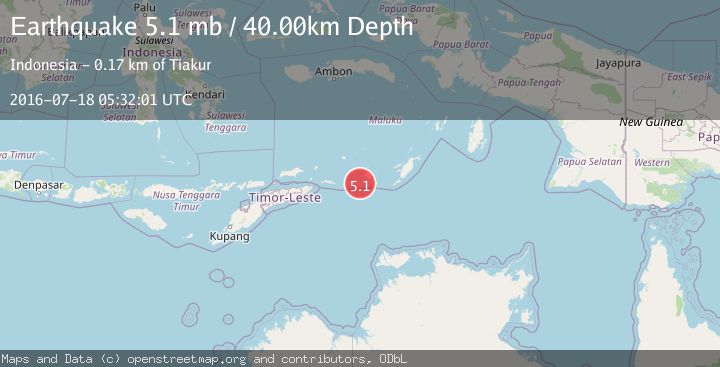
A 5.1 magnitude earthquake struck on KEPULAUAN BABAR, INDONESIA, at Mon, 18 Jul 2016 05:32:01 GMT. Depth: 40km. Reviewed by EMSC seismologists, this moderate quake occurred at a magnitude type of mb.
Magnitude
5.1
mb
Source
EMSC
Intensity
-
Agency Reports
1 Sources| Source | Magnitude | Depth | Time |
|---|---|---|---|
| EMSCPrimary | 5.1 | 40 km | 9 years ago |
Earthquake Details
AutomaticEvent IDemsc_EMSC_20160718_0000031
Tsunami PotentialNo
Magnitude Typemb
Nearest Places
- 38.1 km
- 39.1 km
- 39.5 km
- 39.9 km
- 40.2 km
Comments
Join the discussion about this event.
Latest Earthquakes
2.0Mag
Antofagasta, Chile
Time2 hours ago
Depth89.48 km
SourceVYT (Automatic)
2.8Mag
San Juan, Argentina
Time2 hours ago
Depth114.38 km
SourceVYT (Automatic)
4.3Mag
Timor Sea
Time2 hours ago
Depth229.37 km
SourceVYT (Automatic)
4.5Mag
Banda Sea
Time2 hours ago
Depth197.51 km
SourceVYT (Automatic)
2.4Mag
Southeastern Alaska
Time2 hours ago
Depth0.00 km
SourceVYT (Automatic)
Nearby Earthquakes
4.3Mag
Timor Sea
Time2 hours ago
Depth229.37 km
SourceVYT (Automatic)
5.9Mag
KEPULAUAN BABAR, INDONESIA
Time15 years ago
Depth12.00 km
SourceEMSC (Automatic)
5.4Mag
KEPULAUAN BABAR, INDONESIA
Time16 years ago
Depth52.00 km
SourceEMSC (Automatic)
5.5Mag
KEPULAUAN BABAR, INDONESIA
Time15 years ago
Depth70.00 km
SourceEMSC (Automatic)
5.4Mag
KEPULAUAN BABAR, INDONESIA
Time20 years ago
Depth2.00 km
SourceEMSC (Automatic)