Earthquake KEP. MENTAWAI REGION, INDONESIA
Thu, 30 Jan 2020 21:53:06 GMT
Time6 years ago
Location
-1.9900, 99.9200
Depth
40.0 KM
Event Summary
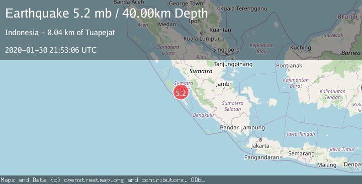
A 5.2 magnitude earthquake struck on KEP. MENTAWAI REGION, INDONESIA, at Thu, 30 Jan 2020 21:53:06 GMT. Depth: 40km. Reviewed by EMSC seismologists, this moderate quake occurred at a magnitude type of mb.
Magnitude
5.2
mb
Source
EMSC
Intensity
-
Agency Reports
1 Sources| Source | Magnitude | Depth | Time |
|---|---|---|---|
| EMSCPrimary | 5.2 | 40 km | 6 years ago |
Earthquake Details
AutomaticEvent IDemsc_EMSC_20200130_0000216
Tsunami PotentialNo
Magnitude Typemb
Nearest Places
- Tanjung Kaikeruaru26.6 km
- Rokot Airport27.1 km
- Rokot27.7 km
- Sipogiri27.9 km
- Selat Mentawai28.1 km
Comments
Join the discussion about this event.
Latest Earthquakes
2.8Mag
Sulawesi, Indonesia
Time2 minutes ago
Depth21.08 km
SourceBMKG
2.1Mag
WESTERN TURKEY
Time7 minutes ago
Depth12.30 km
SourceKOERI (Automatic)
2.2Mag
Alaska Peninsula
Time7 minutes ago
Depth57.74 km
SourceVYT (Automatic)
3.7Mag
WESTERN TURKEY
Time9 minutes ago
Depth13.30 km
SourceKOERI (Automatic)
1.6Mag
27 km ESE of Balmorhea, Texas
Time10 minutes ago
Depth3.56 km
SourceUSGS (Automatic)
Nearby Earthquakes
6.0Mag
KEP. MENTAWAI REGION, INDONESIA
Time18 years ago
Depth51.00 km
SourceEMSC (Automatic)
5.4Mag
KEP. MENTAWAI REGION, INDONESIA
Time17 years ago
Depth40.00 km
SourceEMSC (Automatic)
3.0Mag
KEP. MENTAWAI REGION, INDONESIA
Time1 year ago
Depth28.00 km
SourceBMKG (Automatic)
3.0Mag
SOUTHERN SUMATRA, INDONESIA
Time1 year ago
Depth14.00 km
SourceBMKG (Automatic)
5.6Mag
KEP. MENTAWAI REGION, INDONESIA
Time18 years ago
Depth2.00 km
SourceEMSC (Automatic)