Earthquake NORTH ISLAND OF NEW ZEALAND
Tue, 04 Feb 2020 09:47:23 GMT
Time6 years ago
Location
-37.6700, 176.5300
Depth
286.0 KM
Event Summary
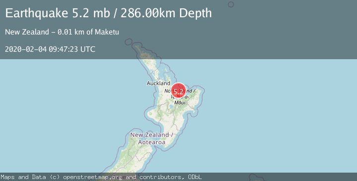
A 5.2 magnitude earthquake struck on NORTH ISLAND OF NEW ZEALAND, at Tue, 04 Feb 2020 09:47:23 GMT. Depth: 286km. Reviewed by EMSC seismologists, this moderate quake occurred at a magnitude type of mb.
Magnitude
5.2
mb
Source
EMSC
Intensity
-
Agency Reports
1 Sources| Source | Magnitude | Depth | Time |
|---|---|---|---|
| EMSCPrimary | 5.2 | 286 km | 6 years ago |
Earthquake Details
AutomaticEvent IDemsc_EMSC_20200204_0000088
Tsunami PotentialNo
Magnitude Typemb
Nearest Places
- Motunau3.3 km
- Bay of Plenty4.7 km
- Motuhaku6.9 km
- Motuhaku Island (Schooner Rocks)8.0 km
- Newdicks Beach9.2 km
Comments
Join the discussion about this event.
Latest Earthquakes
1.3Mag
17 km WSW of Johannesburg, CA
Time1 hour ago
Depth9.21 km
SourceUSGS (Automatic)
2.0Mag
Flores Region, Indonesia
Time1 hour ago
Depth27.22 km
SourceBMKG
1.4Mag
31 km WSW of Ackerly, Texas
Time1 hour ago
Depth9.49 km
SourceUSGS (Automatic)
2.0Mag
Poland
Time1 hour ago
Depth0.00 km
SourceVYT (Automatic)
2.6Mag
Java, Indonesia
Time1 hour ago
Depth31.33 km
SourceBMKG
Nearby Earthquakes
4.0Mag
NORTH ISLAND OF NEW ZEALAND
Time3 months ago
Depth151.60 km
SourceGNS (Automatic)
3.0Mag
NORTH ISLAND OF NEW ZEALAND
Time4 years ago
Depth134.00 km
SourceGNS (Automatic)
3.2Mag
NORTH ISLAND OF NEW ZEALAND
Time1 month ago
Depth194.90 km
SourceGNS (Automatic)
5.0Mag
NORTH ISLAND OF NEW ZEALAND
Time4 years ago
Depth229.00 km
SourceEMSC (Automatic)
2.1Mag
North Island, New Zealand
Time1 week ago
Depth120.80 km
SourceGNS