Earthquake RAT ISLANDS, ALEUTIAN ISLANDS
Tue, 04 Feb 2020 22:17:45 GMT
Time6 years ago
Location
51.9300, 178.4700
Depth
121.0 KM
Event Summary
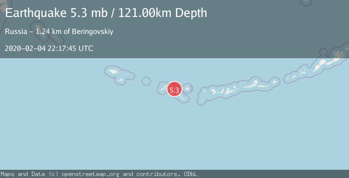
A 5.3 magnitude earthquake struck on RAT ISLANDS, ALEUTIAN ISLANDS, at Tue, 04 Feb 2020 22:17:45 GMT. Depth: 121km. Reviewed by EMSC seismologists, this moderate quake occurred at a magnitude type of mb.
Magnitude
5.3
mb
Source
EMSC
Intensity
-
Agency Reports
1 Sources| Source | Magnitude | Depth | Time |
|---|---|---|---|
| EMSCPrimary | 5.3 | 121 km | 6 years ago |
Earthquake Details
AutomaticEvent IDemsc_EMSC_20200204_0000281
Tsunami PotentialNo
Magnitude Typemb
Nearest Places
- Double Point0.5 km
- South-southwest Point2.5 km
- Sitkin Point3.0 km
- West Cove3.3 km
- Little Sitkin Island3.7 km
Comments
Join the discussion about this event.
Latest Earthquakes
2.6Mag
western Texas
Time2 minutes ago
Depth12.70 km
SourceVYT (Automatic)
2.0Mag
Sumbawa Region, Indonesia
Time3 minutes ago
Depth21.49 km
SourceBMKG
1.0Mag
Southern Alaska
Time3 minutes ago
Depth1.34 km
SourceVYT (Automatic)
1.7Mag
Dead Sea region
Time5 minutes ago
Depth0.00 km
SourceVYT (Automatic)
2.8Mag
ICELAND
Time6 minutes ago
Depth0.30 km
SourceIMO (Automatic)
Nearby Earthquakes
3.0Mag
RAT ISLANDS, ALEUTIAN ISLANDS
Time11 years ago
Depth162.00 km
SourceNEIR (Automatic)
4.0Mag
RAT ISLANDS, ALEUTIAN ISLANDS
Time7 years ago
Depth121.00 km
SourceNEIC (Automatic)
4.0Mag
RAT ISLANDS, ALEUTIAN ISLANDS
Time9 months ago
Depth120.20 km
SourceAK (Automatic)
3.0Mag
RAT ISLANDS, ALEUTIAN ISLANDS
Time2 years ago
Depth94.90 km
SourceAK (Automatic)
5.0Mag
RAT ISLANDS, ALEUTIAN ISLANDS
Time2 years ago
Depth112.00 km
SourceEMSC (Automatic)