Earthquake MOLUCCA SEA
Sat, 15 Feb 2020 15:36:41 GMT
Time6 years ago
Location
1.6100, 126.4700
Depth
10.0 KM
Event Summary
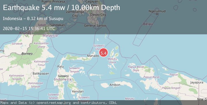
A 5.4 magnitude earthquake struck on MOLUCCA SEA, at Sat, 15 Feb 2020 15:36:41 GMT. Depth: 10km. Reviewed by EMSC seismologists, this moderate quake occurred at a magnitude type of mw.
Magnitude
5.4
mw
Source
EMSC
Intensity
-
Agency Reports
1 Sources| Source | Magnitude | Depth | Time |
|---|---|---|---|
| EMSCPrimary | 5.4 | 10 km | 6 years ago |
Earthquake Details
AutomaticEvent IDemsc_EMSC_20200215_0000127
Tsunami PotentialNo
Magnitude Typemw
Nearest Places
- Kelurahan Bido32.1 km
- Kelurahan Mayau32.3 km
- Pulau Mayu32.9 km
- Kecamatan Pulau Batang Dua33.2 km
- Kelurahan Perum Bersatu33.8 km
Comments
Join the discussion about this event.
Latest Earthquakes
3.5Mag
Fox Islands, Aleutian Islands, Alaska
Time6 minutes ago
Depth72.63 km
SourceVYT (Automatic)
1.8Mag
Kodiak Island region, Alaska
Time8 minutes ago
Depth208.13 km
SourceVYT (Automatic)
2.6Mag
Armenia-Azerbaijan-Iran border region
Time10 minutes ago
Depth0.00 km
SourceVYT (Automatic)
1.9Mag
Southeastern Alaska
Time11 minutes ago
Depth0.00 km
SourceVYT (Automatic)
3.4Mag
western Texas
Time13 minutes ago
Depth2.32 km
SourceVYT (Automatic)
Nearby Earthquakes
5.0Mag
MOLUCCA SEA
Time6 years ago
Depth49.00 km
SourceEMSC (Automatic)
4.0Mag
MOLUCCA SEA
Time1 year ago
Depth10.00 km
SourceBMKG (Automatic)
5.3Mag
MOLUCCA SEA
Time15 years ago
Depth30.00 km
SourceEMSC (Automatic)
6.0Mag
MOLUCCA SEA
Time6 years ago
Depth30.00 km
SourceEMSC (Automatic)
3.0Mag
MOLUCCA SEA
Time6 years ago
Depth30.00 km
SourceDJA (Automatic)