Earthquake KEPULAUAN BARAT DAYA, INDONESIA
Sat, 07 Mar 2020 11:35:26 GMT
Time5 years ago
Location
-7.4100, 128.6900
Depth
166.0 KM
Event Summary
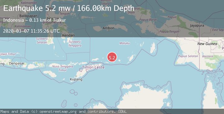
A 5.2 magnitude earthquake struck on KEPULAUAN BARAT DAYA, INDONESIA, at Sat, 07 Mar 2020 11:35:26 GMT. Depth: 166km. Reviewed by EMSC seismologists, this moderate quake occurred at a magnitude type of mw.
Magnitude
5.2
mw
Source
EMSC
Intensity
-
Agency Reports
1 Sources| Source | Magnitude | Depth | Time |
|---|---|---|---|
| EMSCPrimary | 5.2 | 166 km | 5 years ago |
Earthquake Details
AutomaticEvent IDemsc_EMSC_20200307_0000082
Tsunami PotentialNo
Magnitude Typemw
Nearest Places
- Pulau Terbang Selatan15.1 km
- Pulau Terbang Utara18.8 km
- Tanjung Paran22.1 km
- Tanjung Watlewantutu22.9 km
- Desa Wulur26.2 km
Comments
Join the discussion about this event.
Latest Earthquakes
2.3Mag
Antofagasta, Chile
Time1 minute ago
Depth82.15 km
SourceVYT (Automatic)
2.1Mag
Southern Alaska
Time4 minutes ago
Depth64.21 km
SourceVYT (Automatic)
2.5Mag
Central Alaska
Time9 minutes ago
Depth312.99 km
SourceVYT (Automatic)
3.6Mag
Banda Sea
Time16 minutes ago
Depth0.00 km
SourceVYT (Automatic)
1.9Mag
western Texas
Time21 minutes ago
Depth0.24 km
SourceVYT (Automatic)
Nearby Earthquakes
6.3Mag
KEPULAUAN BARAT DAYA, INDONESIA
Time7 years ago
Depth143.00 km
SourceEMSC (Automatic)
5.0Mag
KEPULAUAN BARAT DAYA, INDONESIA
Time15 years ago
Depth153.00 km
SourceEMSC (Automatic)
5.5Mag
KEPULAUAN BARAT DAYA, INDONESIA
Time1 year ago
Depth149.00 km
SourceEMSC (Automatic)
4.0Mag
KEPULAUAN BARAT DAYA, INDONESIA
Time7 years ago
Depth161.00 km
SourceNEIC (Automatic)
5.0Mag
Banda Sea
Time2 weeks ago
Depth160.88 km
SourceBMKG (Automatic)