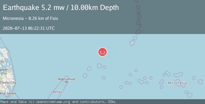
Earthquake STATE OF YAP, MICRONESIA
Mon, 13 Jul 2020 06:22:31 GMT
Time5 years ago
Location
12.0500, 140.2100
Depth
10.0 KM
Event Summary
A 5.2 magnitude earthquake struck on STATE OF YAP, MICRONESIA, at Mon, 13 Jul 2020 06:22:31 GMT. Depth: 10km. Reviewed by EMSC seismologists, this moderate quake occurred at a magnitude type of mw.
Magnitude
5.2
mw
Source
EMSC
Intensity
I
Agency Reports
1 Sources| Source | Magnitude | Depth | Time |
|---|---|---|---|
| EMSCPrimary | 5.2 | 10 km | 5 years ago |
Earthquake Details
AutomaticEvent IDemsc_EMSC_20200713_0000033
QualityS
Tsunami PotentialNo
Magnitude Typemw
Last Update3 months ago
Nearest Places
Possibly felt by: 20
- IFais256.2 km215 people
Felt Reports0
Did you feel this earthquake? Report it to help others.
No reports yet
Be the first to report this earthquake!
Latest Earthquakes
Loading...
Nearby Earthquakes
4.7Mag
STATE OF YAP, MICRONESIA
Time4 months ago
Depth10.00 km
SourceEMSC (Automatic)
5.1Mag
STATE OF YAP, MICRONESIA
Time5 years ago
Depth10.00 km
SourceEMSC (Automatic)
6.2Mag
STATE OF YAP, MICRONESIA
Time5 years ago
Depth10.00 km
SourceEMSC (Automatic)
5.6Mag
MARIANA ISLANDS REGION
Time9 years ago
Depth20.00 km
SourceEMSC (Automatic)
5.0Mag
STATE OF YAP, MICRONESIA
Time9 years ago
Depth60.00 km
SourceEMSC (Automatic)