Earthquake SOUTH OF KERMADEC ISLANDS
Sun, 13 Sep 2020 11:47:19 GMT
Time5 years ago
Location
-32.9600, -178.4900
Depth
10.0 KM
Event Summary
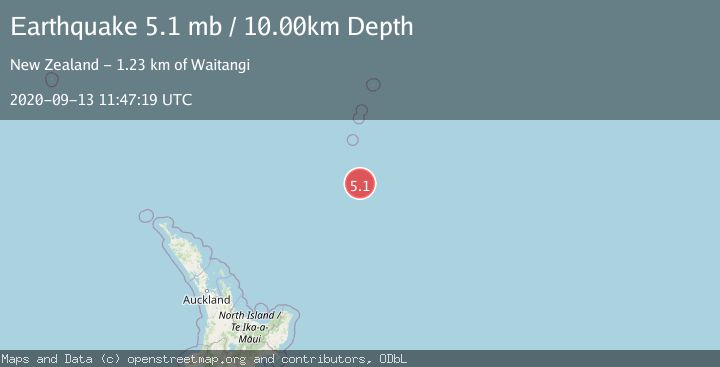
A 5.1 magnitude earthquake struck on SOUTH OF KERMADEC ISLANDS, at Sun, 13 Sep 2020 11:47:19 GMT. Depth: 10km. Reviewed by EMSC seismologists, this moderate quake occurred at a magnitude type of mb.
Magnitude
5.1
mb
Source
EMSC
Intensity
-
Agency Reports
1 Sources| Source | Magnitude | Depth | Time |
|---|---|---|---|
| EMSCPrimary | 5.1 | 10 km | 5 years ago |
Earthquake Details
AutomaticEvent IDemsc_EMSC_20200913_0000079
Tsunami PotentialNo
Magnitude Typemb
Nearest Places
- 83.1 km
- 113.4 km
- 121.0 km
- 127.3 km
- 135.3 km
Comments
Join the discussion about this event.
Latest Earthquakes
2.0Mag
Poland
Time3 minutes ago
Depth5.62 km
SourceVYT (Automatic)
1.4Mag
3 km WSW of Mira Loma, CA
Time3 minutes ago
Depth7.18 km
SourceUSGS (Automatic)
2.6Mag
Southern Alaska
Time11 minutes ago
Depth42.60 km
SourceVYT (Automatic)
1.8Mag
STRAIT OF GIBRALTAR
Time11 minutes ago
Depth2.30 km
SourceIGN (Automatic)
2.8Mag
south of Java, Indonesia
Time12 minutes ago
Depth0.00 km
SourceVYT (Automatic)
Nearby Earthquakes
5.0Mag
SOUTH OF KERMADEC ISLANDS
Time10 years ago
Depth10.00 km
SourceEMSC (Automatic)
5.1Mag
SOUTH OF KERMADEC ISLANDS
Time18 years ago
Depth2.00 km
SourceEMSC (Automatic)
5.1Mag
SOUTH OF KERMADEC ISLANDS
Time9 years ago
Depth10.00 km
SourceEMSC (Automatic)
5.2Mag
SOUTH OF KERMADEC ISLANDS
Time10 years ago
Depth10.00 km
SourceEMSC (Automatic)
5.6Mag
SOUTH OF KERMADEC ISLANDS
Time13 years ago
Depth2.00 km
SourceEMSC (Automatic)