Earthquake SOUTHWEST OF SUMATRA, INDONESIA
Wed, 10 Feb 2021 12:52:28 GMT
Time5 years ago
Location
-5.6200, 101.7300
Depth
10.0 KM
Event Summary
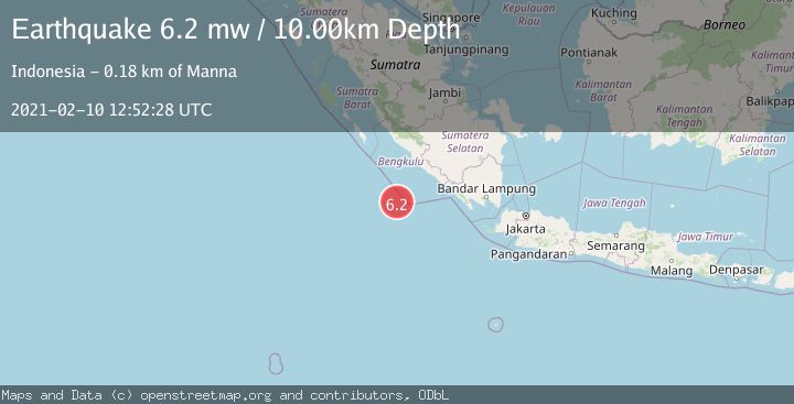
A 6.2 magnitude earthquake struck on SOUTHWEST OF SUMATRA, INDONESIA, at Wed, 10 Feb 2021 12:52:28 GMT. Depth: 10km. Reviewed by EMSC seismologists, this strong quake occurred at a magnitude type of mw.
Magnitude
6.2
mw
Source
EMSC
Intensity
-
Agency Reports
1 Sources| Source | Magnitude | Depth | Time |
|---|---|---|---|
| EMSCPrimary | 6.2 | 10 km | 5 years ago |
Earthquake Details
AutomaticEvent IDemsc_EMSC_20210210_0000102
Tsunami PotentialNo
Magnitude Typemw
Nearest Places
- Tanjung Kooma51.2 km
- Gunung Dupaaube52.7 km
- Desa Banjar Sari55.5 km
- Pahanumo55.7 km
- Tanjung Kiojah57.0 km
Comments
Join the discussion about this event.
Latest Earthquakes
1.0Mag
29 km W of Garden City, Texas
Time5 minutes ago
Depth3.03 km
SourceUSGS (Automatic)
2.1Mag
6 km NE of Beaverdam, Nevada
Time6 minutes ago
Depth11.45 km
SourceUSGS (Automatic)
3.4Mag
NORTH ISLAND OF NEW ZEALAND
Time13 minutes ago
Depth146.90 km
SourceGNS (Automatic)
2.6Mag
WESTERN TURKEY
Time19 minutes ago
Depth7.30 km
SourceKOERI (Automatic)
3.7Mag
YUNNAN, CHINA
Time20 minutes ago
Depth10.00 km
SourceTSB (Automatic)
Nearby Earthquakes
5.2Mag
SOUTHWEST OF SUMATRA, INDONESIA
Time5 years ago
Depth23.00 km
SourceEMSC (Automatic)
5.1Mag
SOUTHWEST OF SUMATRA, INDONESIA
Time20 years ago
Depth33.00 km
SourceEMSC (Automatic)
5.8Mag
SOUTHWEST OF SUMATRA, INDONESIA
Time16 years ago
Depth10.00 km
SourceEMSC (Automatic)
5.5Mag
SOUTHWEST OF SUMATRA, INDONESIA
Time15 years ago
Depth10.00 km
SourceEMSC (Automatic)
5.3Mag
SOUTHWEST OF SUMATRA, INDONESIA
Time16 years ago
Depth10.00 km
SourceEMSC (Automatic)