Earthquake SOUTHWEST OF SUMATRA, INDONESIA
Sat, 13 Feb 2021 04:30:57 GMT
Time5 years ago
Location
-6.2100, 103.8000
Depth
38.0 KM
Event Summary
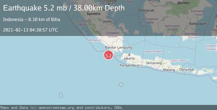
A 5.2 magnitude earthquake struck on SOUTHWEST OF SUMATRA, INDONESIA, at Sat, 13 Feb 2021 04:30:57 GMT. Depth: 38km. Reviewed by EMSC seismologists, this moderate quake occurred at a magnitude type of mb.
Magnitude
5.2
mb
Source
EMSC
Intensity
-
Agency Reports
1 Sources| Source | Magnitude | Depth | Time |
|---|---|---|---|
| EMSCPrimary | 5.2 | 38 km | 5 years ago |
Earthquake Details
AutomaticEvent IDemsc_EMSC_20210213_0000040
Tsunami PotentialNo
Magnitude Typemb
Nearest Places
- Enggano Basin24.0 km
- Pulau Betuah79.4 km
- Tanjung Cuku Balimbing81.0 km
- Cukuh Batuberagam85.2 km
- Wai Cukung85.7 km
Comments
Join the discussion about this event.
Latest Earthquakes
2.5Mag
Minahasa, Sulawesi, Indonesia
Time3 hours ago
Depth3.05 km
SourceVYT (Automatic)
2.6Mag
Antofagasta, Chile
Time3 hours ago
Depth125.12 km
SourceVYT (Automatic)
0.8Mag
7 km NW of The Geysers, CA
Time3 hours ago
Depth1.32 km
SourceUSGS (Automatic)
2.5Mag
San Juan, Argentina
Time4 hours ago
Depth363.53 km
SourceVYT (Automatic)
2.5Mag
Java, Indonesia
Time4 hours ago
Depth115.43 km
SourceBMKG
Nearby Earthquakes
3.0Mag
SOUTHWEST OF SUMATRA, INDONESIA
Time3 years ago
Depth10.00 km
SourceDJA (Automatic)
5.1Mag
SOUTHWEST OF SUMATRA, INDONESIA
Time3 years ago
Depth40.00 km
SourceEMSC (Automatic)
4.0Mag
SOUTHWEST OF SUMATRA, INDONESIA
Time4 years ago
Depth10.00 km
SourceDJA (Automatic)
4.0Mag
SOUTHWEST OF SUMATRA, INDONESIA
Time6 years ago
Depth139.00 km
SourceDJA (Automatic)
5.0Mag
SOUTHWEST OF SUMATRA, INDONESIA
Time2 years ago
Depth43.00 km
SourceEMSC (Automatic)