Earthquake KERMADEC ISLANDS REGION
Sun, 06 Jun 2021 23:16:39 GMT
Time4 years ago
Location
-27.7100, -176.3000
Depth
10.0 KM
Event Summary
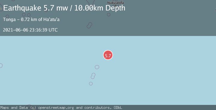
A 5.7 magnitude earthquake struck on KERMADEC ISLANDS REGION, at Sun, 06 Jun 2021 23:16:39 GMT. Depth: 10km. Reviewed by EMSC seismologists, this moderate quake occurred at a magnitude type of mw.
Magnitude
5.7
mw
Source
EMSC
Intensity
-
Agency Reports
1 Sources| Source | Magnitude | Depth | Time |
|---|---|---|---|
| EMSCPrimary | 5.7 | 10 km | 4 years ago |
Earthquake Details
AutomaticEvent IDemsc_EMSC_20210606_0000376
Tsunami PotentialNo
Magnitude Typemw
Nearest Places
- 134.1 km
- 149.1 km
- 179.0 km
- 185.1 km
- 224.8 km
Comments
Join the discussion about this event.
Latest Earthquakes
0.8Mag
6 km NW of The Geysers, CA
Time8 minutes ago
Depth3.38 km
SourceUSGS (Automatic)
1.8Mag
Sulawesi, Indonesia
Time12 minutes ago
Depth6.47 km
SourceVYT (Automatic)
2.6Mag
Alaska Peninsula
Time14 minutes ago
Depth67.50 km
SourceVYT (Automatic)
0.6Mag
6 km NW of The Geysers, CA
Time14 minutes ago
Depth3.63 km
SourceUSGS (Automatic)
3.3Mag
northern Sumatra, Indonesia
Time15 minutes ago
Depth0.00 km
SourceVYT (Automatic)
Nearby Earthquakes
5.4Mag
KERMADEC ISLANDS REGION
Time12 years ago
Depth10.00 km
SourceEMSC (Automatic)
5.1Mag
KERMADEC ISLANDS REGION
Time1 year ago
Depth10.00 km
SourceEMSC (Automatic)
5.5Mag
KERMADEC ISLANDS REGION
Time4 years ago
Depth10.00 km
SourceEMSC (Automatic)
5.0Mag
KERMADEC ISLANDS REGION
Time9 years ago
Depth2.00 km
SourceEMSC (Automatic)
5.5Mag
KERMADEC ISLANDS REGION
Time6 years ago
Depth10.00 km
SourceEMSC (Automatic)