Earthquake NEAR EAST COAST OF KAMCHATKA
Mon, 12 Jan 2026 05:00:44 GMT
Time1 month ago
Location
51.9187, 158.5070
Depth
66.0 KM
Event Summary
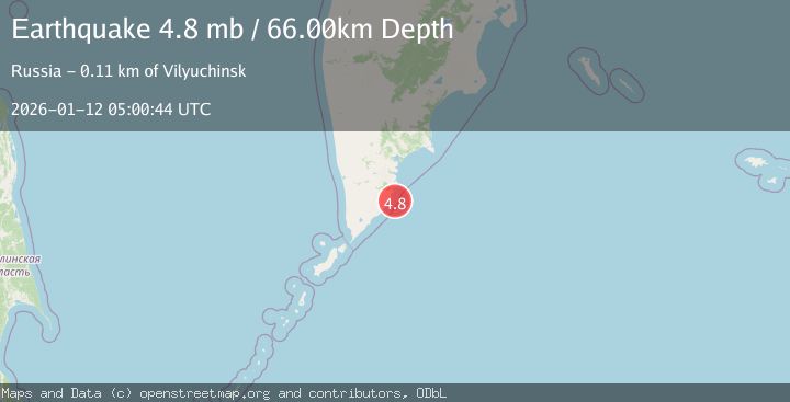
A 4.8 magnitude earthquake struck on NEAR EAST COAST OF KAMCHATKA, at Mon, 12 Jan 2026 05:00:44 GMT. Depth: 66km. Reviewed by EMSC seismologists, this light quake occurred at a magnitude type of mb.
Magnitude
4.8
mb
Source
EMSC
Intensity
-
Agency Reports
1 Sources| Source | Magnitude | Depth | Time |
|---|---|---|---|
| EMSCPrimary | 4.8 | 66 km | 1 month ago |
Earthquake Details
AutomaticEvent IDemsc_EMSC_20260112_0000092
Tsunami PotentialNo
Magnitude Typemb
Nearest Places
- 17.3 km
- 17.6 km
- 17.9 km
- 17.9 km
- 18.2 km
Comments
Join the discussion about this event.
Latest Earthquakes
4.1Mag
Buru, Indonesia
Time2 minutes ago
Depth10.00 km
SourceVYT (Automatic)
2.3Mag
Unimak Island region, Alaska
Time6 minutes ago
Depth25.76 km
SourceVYT (Automatic)
0.7Mag
3 km NW of The Geysers, CA
Time10 minutes ago
Depth3.14 km
SourceUSGS (Automatic)
2.9Mag
San Juan, Argentina
Time12 minutes ago
Depth10.00 km
SourceVYT (Automatic)
2.2Mag
Minahassa Peninsula, Sulawesi
Time12 minutes ago
Depth128.51 km
SourceBMKG
Nearby Earthquakes
4.2Mag
NEAR EAST COAST OF KAMCHATKA
Time3 weeks ago
Depth78.80 km
SourceNEIC (Automatic)
4.6Mag
NEAR EAST COAST OF KAMCHATKA
Time2 weeks ago
Depth66.00 km
SourceEMSC (Automatic)
4.5Mag
NEAR EAST COAST OF KAMCHATKA
Time2 weeks ago
Depth66.00 km
SourceEMSC (Automatic)
4.0Mag
NEAR EAST COAST OF KAMCHATKA
Time2 months ago
Depth60.00 km
SourceGSRAS (Automatic)
4.4Mag
NEAR EAST COAST OF KAMCHATKA
Time0 months ago
Depth68.10 km
SourceNEIC (Automatic)