Earthquake TONGA REGION
Sun, 18 Jan 2026 12:31:46 GMT
Time4 months ago
Location
-22.4545, -174.5047
Depth
27.0 KM
Event Summary
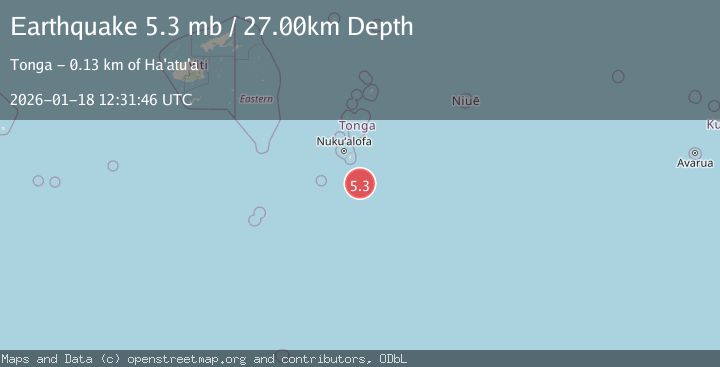
A 5.3 magnitude earthquake struck on TONGA REGION, at Sun, 18 Jan 2026 12:31:46 GMT. Depth: 27km. Reviewed by EMSC seismologists, this moderate quake occurred at a magnitude type of mb.
Magnitude
5.3
mb
Source
EMSC
Intensity
III
Agency Reports
1 Sources| Source | Magnitude | Depth | Time |
|---|---|---|---|
| EMSCPrimary | 5.3 | 27 km | 4 months ago |
Earthquake Details
AutomaticEvent IDemsc_EMSC_20260118_0000164
QualityS
Tsunami PotentialNo
Magnitude Typemb
Last Update3 months ago
Nearest Places
Possibly felt by: 9.7K
Felt Reports0
Did you feel this earthquake? Report it to help others.
No reports yet
Be the first to report this earthquake!
Latest Earthquakes
Loading...
Nearby Earthquakes
4.2Mag
TONGA
Time3 weeks ago
Depth10.00 km
SourceNEIC (Automatic)
5.1Mag
50 km SE of ‘Ohonua, Tonga
Time4 months ago
Depth10.00 km
SourceUSGS
5.4Mag
TONGA
Time4 months ago
Depth32.00 km
SourceEMSC (Automatic)
5.0Mag
TONGA REGION
Time6 months ago
Depth35.00 km
SourceEMSC (Automatic)
5.2Mag
TONGA REGION
Time10 months ago
Depth6.10 km
SourceEMSC (Automatic)