Earthquake SOUTHERN IRAN
Wed, 28 Jan 2026 15:18:02 GMT
Time3 months ago
Location
27.1940, 53.3680
Depth
10.0 KM
Event Summary
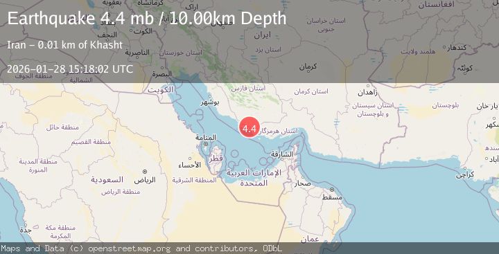
A 4.4 magnitude earthquake struck on SOUTHERN IRAN, at Wed, 28 Jan 2026 15:18:02 GMT. Depth: 10km. Reviewed by GFZ seismologists, this light quake occurred at a magnitude type of mb.
Magnitude
4.4
mb
Source
GFZ
Intensity
V
Agency Reports
2 Sources| Source | Magnitude | Depth | Time |
|---|---|---|---|
| GFZPrimary | 4.4 | 10 km | 3 months ago |
| EMSC | 4.3 | 11 km | 3 months ago |
Earthquake Details
AutomaticEvent IDemsc_GFZ_20260128_0000296
QualityS
Tsunami PotentialNo
Magnitude Typemb
Last Update2 months ago
Nearest Places
Possibly felt by: 18.5K
Felt Reports0
Did you feel this earthquake? Report it to help others.
No reports yet
Be the first to report this earthquake!
Latest Earthquakes
Loading...
Nearby Earthquakes
4.0Mag
SOUTHERN IRAN
Time1 month ago
Depth10.00 km
SourceNEIC (Automatic)
4.3Mag
SOUTHERN IRAN
Time1 month ago
Depth10.00 km
SourceNEIC (Automatic)
4.2Mag
SOUTHERN IRAN
Time1 month ago
Depth10.00 km
SourceNEIC (Automatic)
4.2Mag
SOUTHERN IRAN
Time1 month ago
Depth10.00 km
SourceNEIC (Automatic)
4.5Mag
SOUTHERN IRAN
Time1 month ago
Depth10.00 km
SourceNEIC (Automatic)