Earthquake KURIL ISLANDS
Tue, 17 Feb 2026 08:09:57 GMT
Time1 day ago
Location
49.3770, 155.6690
Depth
54.7 KM
Event Summary
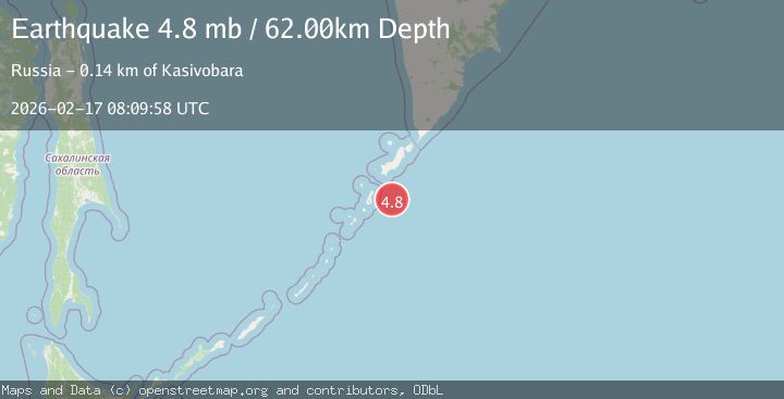
A 4.9 magnitude earthquake struck on KURIL ISLANDS, at Tue, 17 Feb 2026 08:09:57 GMT. Depth: 54.7km. Reviewed by GFZ seismologists, this light quake occurred at a magnitude type of mb.
Magnitude
4.9
mb
Source
GFZ
Intensity
-
Agency Reports
3 Sources| Source | Magnitude | Depth | Time |
|---|---|---|---|
| GFZPrimary | 4.9 | 55 km | 1 day ago |
| GSRAS | 4.9 | 60 km | 1 day ago |
| EMSC | 4.8 | 62 km | 1 day ago |
Earthquake Details
AutomaticEvent IDemsc_GFZ_20260217_0000133
Tsunami PotentialNo
Magnitude Typemb
Nearest Places
- Mys Zelenyy58.9 km
- Bukhta Paganel’59.4 km
- Mys Rakushiy59.5 km
- Skala Kamen’ Yasnoy Pagody59.8 km
- Bukhta Otlivnaya60.0 km
Comments
Join the discussion about this event.
Latest Earthquakes
2.7Mag
Tarapaca, Chile
Time23 hours ago
Depth123.54 km
SourceVYT (Automatic)
1.0Mag
Southeastern Alaska
Time23 hours ago
Depth0.00 km
SourceVYT (Automatic)
1.6Mag
19 km SSE of Lindsay, Texas
Time23 hours ago
Depth9.84 km
SourceUSGS (Automatic)
1.5Mag
63 km E of Pedro Bay, Alaska
Time23 hours ago
Depth116.20 km
SourceUSGS (Automatic)
1.7Mag
Southern Alaska
Time23 hours ago
Depth0.00 km
SourceVYT (Automatic)
Nearby Earthquakes
5.0Mag
KURIL ISLANDS
Time3 years ago
Depth51.00 km
SourceEMSC (Automatic)
5.3Mag
KURIL ISLANDS
Time16 years ago
Depth74.00 km
SourceEMSC (Automatic)
6.2Mag
KURIL ISLANDS
Time1 year ago
Depth41.00 km
SourceEMSC (Automatic)
5.0Mag
KURIL ISLANDS
Time12 years ago
Depth80.00 km
SourceEMSC (Automatic)
4.6Mag
KURIL ISLANDS
Time1 month ago
Depth70.00 km
SourceEMSC (Automatic)