Earthquake SOUTH OF KERMADEC ISLANDS
Fri, 06 Feb 2026 04:39:22 GMT
Time1 month ago
Location
-34.8892, 179.8447
Depth
100.0 KM
Event Summary
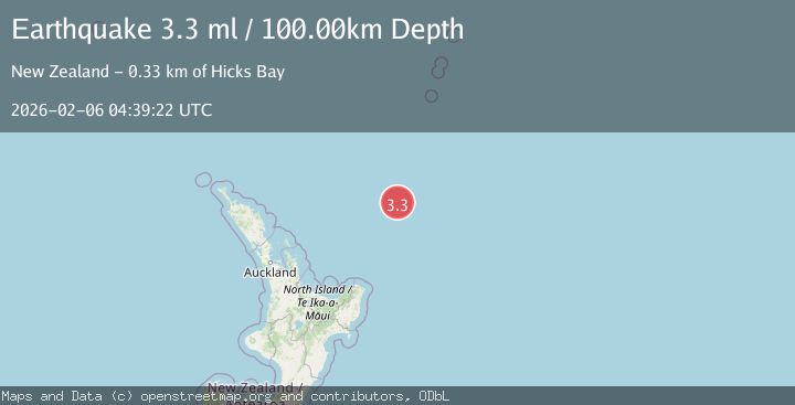
A 3.3 magnitude earthquake struck on SOUTH OF KERMADEC ISLANDS, at Fri, 06 Feb 2026 04:39:22 GMT. Depth: 100km. Reviewed by GNS seismologists, this minor quake occurred at a magnitude type of ml.
Magnitude
3.3
ml
Source
GNS
Intensity
-
Agency Reports
1 Sources| Source | Magnitude | Depth | Time |
|---|---|---|---|
| GNSPrimary | 3.3 | 100 km | 1 month ago |
Earthquake Details
AutomaticEvent IDemsc_GNS_20260206_0000070
QualityS
Tsunami PotentialNo
Magnitude Typeml
Last Update1 month ago
Felt Reports0
Did you feel this earthquake? Report it to help others.
No reports yet
Be the first to report this earthquake!
Latest Earthquakes
Loading...
Nearby Earthquakes
5.2Mag
south of the Kermadec Islands
Time2 days ago
Depth10.00 km
SourceVYT (Automatic)
3.5Mag
OFF E. COAST OF N. ISLAND, N.Z.
Time2 days ago
Depth220.70 km
SourceGNS (Automatic)
4.9Mag
SOUTH OF KERMADEC ISLANDS
Time1 week ago
Depth46.00 km
SourceEMSC (Automatic)
3.9Mag
SOUTH OF KERMADEC ISLANDS
Time1 week ago
Depth100.00 km
SourceGNS (Automatic)
4.2Mag
OFF E. COAST OF N. ISLAND, N.Z.
Time1 week ago
Depth35.00 km
SourceNEIC (Automatic)