Earthquake NORTH ISLAND OF NEW ZEALAND
Wed, 18 Feb 2026 15:02:26 GMT
Time1 hour ago
Location
-39.9935, 176.8518
Depth
38.9 KM
Event Summary
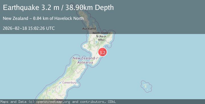
A 3.2 magnitude earthquake struck on NORTH ISLAND OF NEW ZEALAND, at Wed, 18 Feb 2026 15:02:26 GMT. Depth: 38.9km. Reviewed by GNS seismologists, this minor quake occurred at a magnitude type of m.
Magnitude
3.2
m
Source
GNS
Intensity
-
Agency Reports
1 Sources| Source | Magnitude | Depth | Time |
|---|---|---|---|
| GNSPrimary | 3.2 | 39 km | 1 hour ago |
Earthquake Details
AutomaticEvent IDemsc_GNS_20260218_0000236
Tsunami PotentialNo
Magnitude Typem
Nearest Places
- Mangakuri River1.6 km
- Waterfalls Stream1.8 km
- Netherton2.5 km
- Waterfalls Creek2.9 km
- Te Atua3.0 km
Comments
Join the discussion about this event.
Latest Earthquakes
2.5Mag
Antofagasta, Chile
Time1 hour ago
Depth158.08 km
SourceVYT (Automatic)
2.4Mag
Southern Alaska
Time1 hour ago
Depth96.80 km
SourceVYT (Automatic)
2.8Mag
Valparaiso, Chile
Time1 hour ago
Depth136.11 km
SourceVYT (Automatic)
1.3Mag
7 km ENE of Aromas, CA
Time1 hour ago
Depth5.11 km
SourceUSGS (Automatic)
1.3Mag
Kenai Peninsula, Alaska
Time1 hour ago
Depth0.00 km
SourceVYT (Automatic)
Nearby Earthquakes
3.0Mag
NORTH ISLAND OF NEW ZEALAND
Time3 years ago
Depth45.00 km
SourceGNS (Automatic)
3.0Mag
NORTH ISLAND OF NEW ZEALAND
Time4 years ago
Depth20.00 km
SourceGNS (Automatic)
3.1Mag
NORTH ISLAND OF NEW ZEALAND
Time1 week ago
Depth25.70 km
SourceGNS (Automatic)
3.0Mag
NORTH ISLAND OF NEW ZEALAND
Time11 months ago
Depth35.20 km
SourceGNS (Automatic)
3.0Mag
NORTH ISLAND OF NEW ZEALAND
Time6 months ago
Depth31.30 km
SourceGNS (Automatic)