Earthquake EAST OF KURIL ISLANDS
Tue, 03 Feb 2026 05:23:17 GMT
Time2 weeks ago
Location
50.9800, 159.7000
Depth
45.0 KM
Event Summary
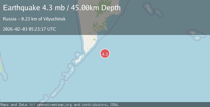
A 4.3 magnitude earthquake struck on EAST OF KURIL ISLANDS, at Tue, 03 Feb 2026 05:23:17 GMT. Depth: 45km. Reviewed by GSRAS seismologists, this light quake occurred at a magnitude type of mb.
Magnitude
4.3
mb
Source
GSRAS
Intensity
-
Agency Reports
1 Sources| Source | Magnitude | Depth | Time |
|---|---|---|---|
| GSRASPrimary | 4.3 | 45 km | 2 weeks ago |
Earthquake Details
AutomaticEvent IDemsc_GSRAS_20260203_0000103
Tsunami PotentialNo
Magnitude Typemb
Nearest Places
- 91.0 km
- 144.2 km
- 144.2 km
- 144.7 km
- 144.8 km
Comments
Join the discussion about this event.
Latest Earthquakes
4.0Mag
off the coast of Coquimbo, Chile
Time13 minutes ago
Depth10.00 km
SourceVYT (Automatic)
1.8Mag
Southern California
Time13 minutes ago
Depth6.71 km
SourceVYT (Automatic)
2.1Mag
near the coast of Tarapaca, Chile
Time14 minutes ago
Depth30.88 km
SourceVYT (Automatic)
2.4Mag
PYRENEES
Time14 minutes ago
Depth0.00 km
SourceReNaSS (Automatic)
2.4Mag
CENTRAL TURKEY
Time24 minutes ago
Depth4.80 km
SourceKOERI (Automatic)
Nearby Earthquakes
5.0Mag
EAST OF KURIL ISLANDS
Time2 weeks ago
Depth12.00 km
SourceEMSC (Automatic)
4.4Mag
OFF EAST COAST OF KAMCHATKA
Time1 month ago
Depth10.00 km
SourceNEIC (Automatic)
4.0Mag
OFF EAST COAST OF KAMCHATKA
Time1 year ago
Depth10.00 km
SourceGSRAS (Automatic)
4.4Mag
OFF EAST COAST OF KAMCHATKA
Time1 month ago
Depth20.00 km
SourceEMSC (Automatic)
5.2Mag
EAST OF KURIL ISLANDS
Time3 weeks ago
Depth13.00 km
SourceEMSC (Automatic)