Earthquake STRAIT OF GIBRALTAR
Mon, 12 Jan 2026 21:20:41 GMT
Time1 month ago
Location
36.6782, -7.8102
Depth
0.0 KM
Event Summary
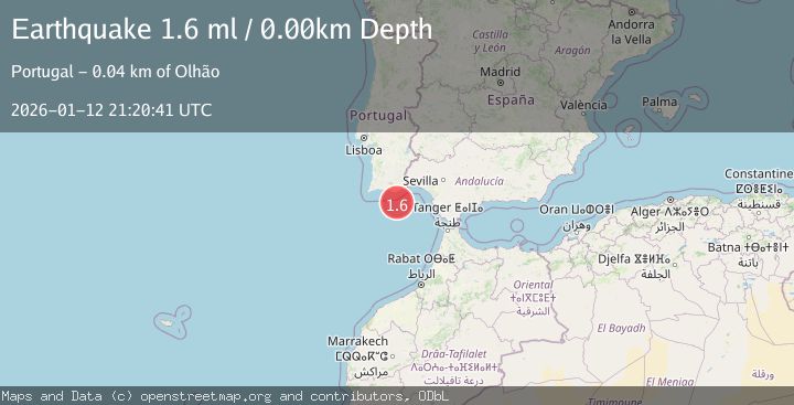
A 1.6 magnitude earthquake struck on STRAIT OF GIBRALTAR, at Mon, 12 Jan 2026 21:20:41 GMT. Depth: 0km. Reviewed by IGN seismologists, this minor quake occurred at a magnitude type of ml.
Magnitude
1.6
ml
Source
IGN
Intensity
-
Agency Reports
1 Sources| Source | Magnitude | Depth | Time |
|---|---|---|---|
| IGNPrimary | 1.6 | 0 km | 1 month ago |
Earthquake Details
AutomaticEvent IDemsc_IGN_20260112_0000337
Tsunami PotentialNo
Magnitude Typeml
Nearest Places
- Ribeira da Pardiela23.8 km
- Cabo de Santa Maria32.2 km
- Barra Nova32.2 km
- Praia Da Ilha Deserta32.3 km
- Praia da Barreta32.7 km
Comments
Join the discussion about this event.
Latest Earthquakes
1.8Mag
Tarapaca, Chile
Time48 seconds ago
Depth106.45 km
SourceVYT (Automatic)
2.2Mag
Tarapaca, Chile
Time6 minutes ago
Depth111.94 km
SourceVYT (Automatic)
1.9Mag
Central Alaska
Time7 minutes ago
Depth32.10 km
SourceVYT (Automatic)
3.4Mag
HAWAII REGION, HAWAII
Time7 minutes ago
Depth4.70 km
SourceHV (Automatic)
1.9Mag
STRAIT OF GIBRALTAR
Time11 minutes ago
Depth0.00 km
SourceIGN (Automatic)
Nearby Earthquakes
2.4Mag
STRAIT OF GIBRALTAR
Time1 week ago
Depth21.20 km
SourceIGN (Automatic)
3.0Mag
STRAIT OF GIBRALTAR
Time15 years ago
Depth45.40 km
SourceEMSC (Automatic)
3.0Mag
STRAIT OF GIBRALTAR
Time6 years ago
Depth30.00 km
SourceEMSC (Automatic)
3.0Mag
STRAIT OF GIBRALTAR
Time25 years ago
Depth15.00 km
SourceEMSC (Automatic)
1.6Mag
STRAIT OF GIBRALTAR
Time1 month ago
Depth27.50 km
SourceIGN (Automatic)