Earthquake STRAIT OF GIBRALTAR
Thu, 19 Feb 2026 02:35:47 GMT
Time1 day ago
Location
36.9950, -5.0883
Depth
27.4 KM
Event Summary
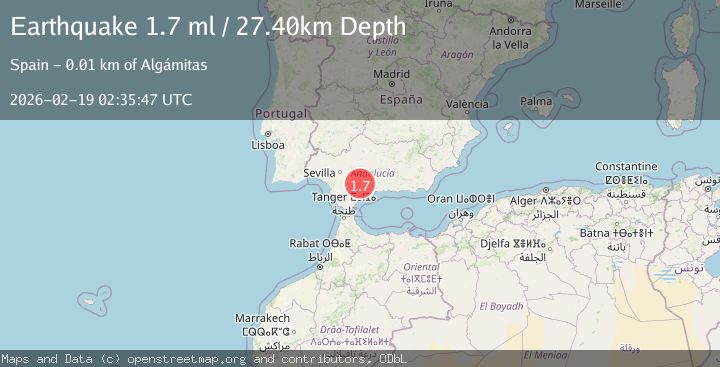
A 1.7 magnitude earthquake struck on STRAIT OF GIBRALTAR, at Thu, 19 Feb 2026 02:35:47 GMT. Depth: 27.4km. Reviewed by IGN seismologists, this minor quake occurred at a magnitude type of ml.
Magnitude
1.7
ml
Source
IGN
Intensity
-
Agency Reports
1 Sources| Source | Magnitude | Depth | Time |
|---|---|---|---|
| IGNPrimary | 1.7 | 27 km | 1 day ago |
Earthquake Details
AutomaticEvent IDemsc_IGN_20260219_0000033
Tsunami PotentialNo
Magnitude Typeml
Nearest Places
- Arroyo de Pasada Honda4.7 km
- Estación de Cañete5.0 km
- El Ojo de la Laguna5.1 km
- Arroyo del Cerezo5.3 km
- Sierra Blanquilla5.7 km
Comments
Join the discussion about this event.
Latest Earthquakes
1.2Mag
Central Alaska
Time6 hours ago
Depth32.71 km
SourceVYT (Automatic)
2.4Mag
DODECANESE IS.-TURKEY BORDER REG
Time6 hours ago
Depth8.10 km
SourceKOERI (Automatic)
1.5Mag
western Texas
Time6 hours ago
Depth0.24 km
SourceVYT (Automatic)
1.8Mag
western Texas
Time6 hours ago
Depth9.77 km
SourceVYT (Automatic)
0.8Mag
Southern Alaska
Time6 hours ago
Depth5.62 km
SourceVYT (Automatic)
Nearby Earthquakes
1.5Mag
SPAIN
Time1 month ago
Depth14.50 km
SourceIGN (Automatic)
2.1Mag
STRAIT OF GIBRALTAR
Time5 days ago
Depth11.30 km
SourceIGN (Automatic)
3.0Mag
SPAIN
Time6 years ago
Depth51.00 km
SourceEMSC (Automatic)
1.5Mag
STRAIT OF GIBRALTAR
Time1 day ago
Depth0.40 km
SourceIGN (Automatic)
3.0Mag
SPAIN
Time4 years ago
Depth8.00 km
SourceMDD (Automatic)