Earthquake NEAR COAST OF SOUTHERN PERU
Sat, 15 Feb 2020 21:47:00 GMT
Time6 years ago
Location
-16.5300, -72.7200
Depth
48.0 KM
Event Summary
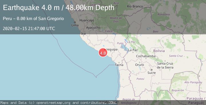
A 4.0 magnitude earthquake struck on NEAR COAST OF SOUTHERN PERU, at Sat, 15 Feb 2020 21:47:00 GMT. Depth: 48km. Reviewed by LIM seismologists, this light quake occurred at a magnitude type of m.
Magnitude
4.0
m
Source
LIM
Intensity
-
Agency Reports
1 Sources| Source | Magnitude | Depth | Time |
|---|---|---|---|
| LIMPrimary | 4.0 | 48 km | 6 years ago |
Earthquake Details
AutomaticEvent IDemsc_LIM_20200215_0000176
Tsunami PotentialNo
Magnitude Typem
Nearest Places
- Cerro Altos de Pampatá2.1 km
- Quebrada Tirita2.3 km
- El Túnel2.7 km
- Quebrada La Matanza2.7 km
- Pampatá3.3 km
Comments
Join the discussion about this event.
Latest Earthquakes
0.8Mag
7 km NW of The Geysers, CA
Time4 minutes ago
Depth1.32 km
SourceUSGS (Automatic)
2.5Mag
San Juan, Argentina
Time9 minutes ago
Depth363.53 km
SourceVYT (Automatic)
2.5Mag
Java, Indonesia
Time9 minutes ago
Depth115.43 km
SourceBMKG
3.9Mag
Halmahera, Indonesia
Time11 minutes ago
Depth161.01 km
SourceVYT (Automatic)
1.0Mag
3 km W of Cobb, CA
Time12 minutes ago
Depth2.45 km
SourceUSGS (Automatic)
Nearby Earthquakes
4.0Mag
NEAR COAST OF SOUTHERN PERU
Time3 months ago
Depth62.00 km
SourceLIM (Automatic)
4.0Mag
NEAR COAST OF SOUTHERN PERU
Time4 years ago
Depth72.00 km
SourceLIM (Automatic)
4.0Mag
NEAR COAST OF SOUTHERN PERU
Time2 years ago
Depth64.00 km
SourceLIM (Automatic)
4.0Mag
NEAR COAST OF SOUTHERN PERU
Time1 year ago
Depth42.00 km
SourceLIM (Automatic)
4.0Mag
NEAR COAST OF SOUTHERN PERU
Time1 year ago
Depth125.30 km
SourceNEIC (Automatic)