Earthquake PERU-ECUADOR BORDER REGION
Tue, 13 Jan 2026 03:02:01 GMT
Time3 months ago
Location
-4.8200, -80.8300
Depth
35.0 KM
Event Summary
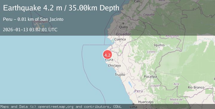
A 4.2 magnitude earthquake struck on PERU-ECUADOR BORDER REGION, at Tue, 13 Jan 2026 03:02:01 GMT. Depth: 35km. Reviewed by LIM seismologists, this light quake occurred at a magnitude type of m.
Magnitude
4.2
m
Source
LIM
Intensity
III
Agency Reports
1 Sources| Source | Magnitude | Depth | Time |
|---|---|---|---|
| LIMPrimary | 4.2 | 35 km | 3 months ago |
Earthquake Details
AutomaticEvent IDemsc_LIM_20260113_0000048
QualityS
Tsunami PotentialNo
Magnitude Typem
Last Update2 months ago
Nearest Places
Possibly felt by: 377.6K
- IIISan Jacinto5.8 km
- IIISojo9.1 km
- IIIMarcavelica15.2 km25.6K people
- 16.0 km5.5K people
- IIISalitral17.0 km5.4K people
- IIITamarindo17.1 km
- IIILa Huaca17.6 km8.5K people
- IIISullana18.6 km160.8K people
- IIIQuerecotillo20.5 km25.4K people
- IIIAmotape21.7 km
- IIIArenal23.0 km
- IIIHuangala25.6 km3.7K people
- 27.0 km9.9K people
- 35.4 km14.2K people
- IIIPaita43.5 km56.2K people
- IIISan Martin44.4 km130K people
- IIIPiura47.0 km484.5K people
- 50.0 km7.5K people
- IICatacaos52.3 km57.3K people
- 55.1 km30K people
- IINegritos55.8 km
- IITalara55.9 km99.1K people
- IILa Arena58.1 km
- 62.9 km17.7K people
- 63.1 km4.3K people
- IILobitos64.6 km
- IILa Unión65.5 km34.8K people
- IIVice66.5 km12.9K people
- 67.3 km9.4K people
- IISinchao68.8 km
- 70.4 km
- IIBernal70.6 km5.9K people
- IIEl Alto74.8 km9.3K people
- 78.5 km
- 79.9 km68.8K people
- IISechura82.0 km23K people
- IIMáncora82.8 km9.1K people
- IIPapayal83.2 km5.5K people
- 92.8 km5.8K people
- 94.0 km821 people
- 97.9 km
- ISuyo97.9 km985 people
- 98.5 km
- 99.7 km351 people
- 100.4 km
- 103.5 km12.3K people
- 107.7 km7.9K people
- 108.3 km
- 109.1 km301 people
- 109.3 km246 people
- 109.7 km13K people
- 113.0 km
- 117.3 km
- 117.5 km351 people
- 125.2 km5.3K people
- 125.4 km5.5K people
- 126.1 km973 people
- 127.8 km12.3K people
- 130.2 km
- 134.1 km
- 134.8 km568 people
- 137.7 km
- 144.5 km343 people
- 144.7 km12.5K people
- 145.5 km96.9K people
- 148.6 km871 people
- 151.5 km16.9K people
- 152.5 km
- 156.4 km10.9K people
- 158.9 km487 people
- 158.9 km16.9K people
- 159.7 km8.6K people
- 162.4 km9.1K people
- 163.6 km39.8K people
Felt Reports0
Did you feel this earthquake? Report it to help others.
No reports yet
Be the first to report this earthquake!
Latest Earthquakes
Loading...
Nearby Earthquakes
3.7Mag
PERU-ECUADOR BORDER REGION
Time6 days ago
Depth32.00 km
SourceLIM (Automatic)
3.8Mag
PERU-ECUADOR BORDER REGION
Time1 week ago
Depth30.00 km
SourceLIM (Automatic)
5.0Mag
PERU-ECUADOR BORDER REGION
Time1 week ago
Depth70.00 km
SourceEMSC (Automatic)
4.3Mag
PERU-ECUADOR BORDER REGION
Time2 weeks ago
Depth14.00 km
SourceQUI (Automatic)
4.2Mag
NEAR COAST OF NORTHERN PERU
Time3 weeks ago
Depth31.00 km
SourceLIM (Automatic)