Earthquake NEAR COAST OF CENTRAL PERU
Sat, 17 Jan 2026 08:12:32 GMT
Time1 month ago
Location
-12.4200, -77.0300
Depth
47.0 KM
Event Summary
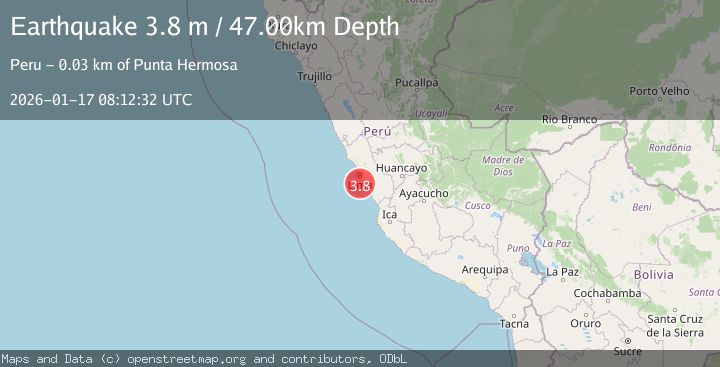
A 3.8 magnitude earthquake struck on NEAR COAST OF CENTRAL PERU, at Sat, 17 Jan 2026 08:12:32 GMT. Depth: 47km. Reviewed by LIM seismologists, this minor quake occurred at a magnitude type of m.
Magnitude
3.8
m
Source
LIM
Intensity
-
Agency Reports
1 Sources| Source | Magnitude | Depth | Time |
|---|---|---|---|
| LIMPrimary | 3.8 | 47 km | 1 month ago |
Earthquake Details
AutomaticEvent IDemsc_LIM_20260117_0000088
Tsunami PotentialNo
Magnitude Typem
Nearest Places
- El Corcovado10.9 km
- Grupo Farallones19.0 km
- Isla Sauce19.0 km
- Peñón San Francisco19.0 km
- Isla Pachacamac19.1 km
Comments
Join the discussion about this event.
Latest Earthquakes
1.6Mag
Southern Alaska
Time8 minutes ago
Depth48.58 km
SourceVYT (Automatic)
2.3Mag
Antofagasta, Chile
Time10 minutes ago
Depth82.15 km
SourceVYT (Automatic)
2.1Mag
Southern Alaska
Time13 minutes ago
Depth64.21 km
SourceVYT (Automatic)
2.5Mag
Central Alaska
Time18 minutes ago
Depth312.99 km
SourceVYT (Automatic)
3.6Mag
Banda Sea
Time25 minutes ago
Depth0.00 km
SourceVYT (Automatic)
Nearby Earthquakes
4.0Mag
NEAR COAST OF CENTRAL PERU
Time4 years ago
Depth50.00 km
SourceLIM (Automatic)
4.0Mag
NEAR COAST OF CENTRAL PERU
Time4 years ago
Depth79.00 km
SourceLIM (Automatic)
5.2Mag
NEAR COAST OF CENTRAL PERU
Time11 years ago
Depth50.00 km
SourceEMSC (Automatic)
4.0Mag
NEAR COAST OF CENTRAL PERU
Time7 months ago
Depth85.00 km
SourceLIM (Automatic)
5.4Mag
NEAR COAST OF CENTRAL PERU
Time3 years ago
Depth59.00 km
SourceEMSC (Automatic)