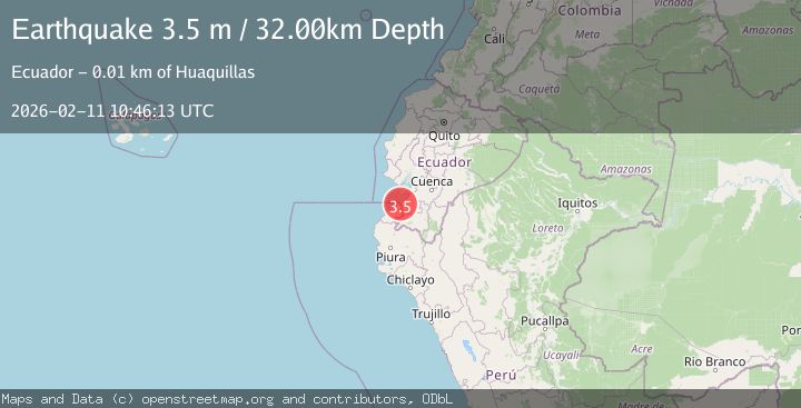
Earthquake PERU-ECUADOR BORDER REGION
Wed, 11 Feb 2026 10:46:13 GMT
Time1 week ago
Location
-3.4300, -80.2100
Depth
32.0 KM
Event Summary
A 3.5 magnitude earthquake struck on PERU-ECUADOR BORDER REGION, at Wed, 11 Feb 2026 10:46:13 GMT. Depth: 32km. Reviewed by LIM seismologists, this minor quake occurred at a magnitude type of m.
Magnitude
3.5
m
Source
LIM
Intensity
-
Agency Reports
1 Sources| Source | Magnitude | Depth | Time |
|---|---|---|---|
| LIMPrimary | 3.5 | 32 km | 1 week ago |
Earthquake Details
AutomaticEvent IDemsc_LIM_20260211_0000173
Tsunami PotentialNo
Magnitude Typem
Nearest Places
- Isla Robato0.7 km
- Isla Pollos0.7 km
- Río Zarumilla1.7 km
- Hito Grau1.8 km
- Estero La Matanza2.1 km
Comments
Join the discussion about this event.
Latest Earthquakes
1.6Mag
Southern Alaska
Time3 minutes ago
Depth48.58 km
SourceVYT (Automatic)
2.3Mag
Antofagasta, Chile
Time5 minutes ago
Depth82.15 km
SourceVYT (Automatic)
2.1Mag
Southern Alaska
Time8 minutes ago
Depth64.21 km
SourceVYT (Automatic)
2.5Mag
Central Alaska
Time13 minutes ago
Depth312.99 km
SourceVYT (Automatic)
3.6Mag
Banda Sea
Time19 minutes ago
Depth0.00 km
SourceVYT (Automatic)
Nearby Earthquakes
4.0Mag
PERU-ECUADOR BORDER REGION
Time5 months ago
Depth56.00 km
SourceLIM (Automatic)
4.0Mag
PERU-ECUADOR BORDER REGION
Time6 years ago
Depth84.00 km
SourceLIM (Automatic)
4.0Mag
PERU-ECUADOR BORDER REGION
Time3 years ago
Depth60.00 km
SourceLIM (Automatic)
4.0Mag
PERU-ECUADOR BORDER REGION
Time1 year ago
Depth54.00 km
SourceQUI (Automatic)
5.1Mag
NEAR COAST OF ECUADOR
Time11 years ago
Depth68.00 km
SourceEMSC (Automatic)