Earthquake KERMADEC ISLANDS, NEW ZEALAND
Wed, 08 Feb 2012 01:58:43 GMT
Time14 years ago
Location
-29.5400, -177.3300
Depth
55.0 KM
Event Summary
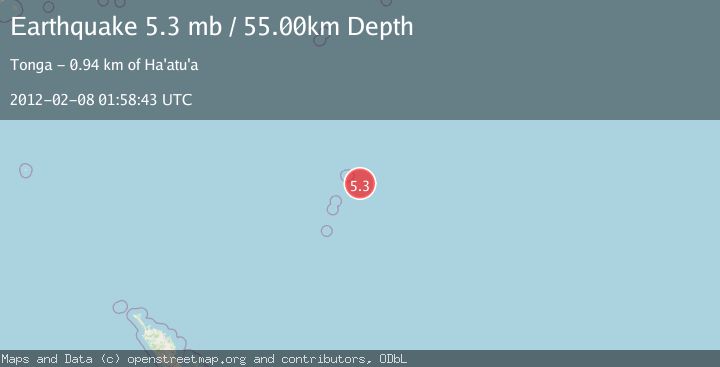
A 5.3 magnitude earthquake struck on KERMADEC ISLANDS, NEW ZEALAND, at Wed, 08 Feb 2012 01:58:43 GMT. Depth: 55km. Reviewed by NEIC seismologists, this moderate quake occurred at a magnitude type of mb.
Magnitude
5.3
mb
Source
NEIC
Intensity
-
Agency Reports
1 Sources| Source | Magnitude | Depth | Time |
|---|---|---|---|
| NEICPrimary | 5.3 | 55 km | 14 years ago |
Earthquake Details
AutomaticEvent IDemsc_NEIC_20120208_0000014
Tsunami PotentialNo
Magnitude Typemb
Nearest Places
- 57.1 km
- 57.1 km
- 58.2 km
- 60.3 km
- 60.6 km
Comments
Join the discussion about this event.
Latest Earthquakes
2.6Mag
Southern Alaska
Time9 minutes ago
Depth60.55 km
SourceVYT (Automatic)
2.0Mag
Java, Indonesia
Time9 minutes ago
Depth43.36 km
SourceBMKG
1.7Mag
11 km SE of Pāhala, Hawaii
Time17 minutes ago
Depth30.91 km
SourceUSGS (Automatic)
3.1Mag
northern Sumatra, Indonesia
Time17 minutes ago
Depth0.00 km
SourceVYT (Automatic)
1.4Mag
Central Alaska
Time19 minutes ago
Depth1.71 km
SourceVYT (Automatic)
Nearby Earthquakes
5.7Mag
KERMADEC ISLANDS, NEW ZEALAND
Time19 years ago
Depth33.00 km
SourceEMSC (Automatic)
5.1Mag
KERMADEC ISLANDS, NEW ZEALAND
Time16 years ago
Depth49.00 km
SourceEMSC (Automatic)
5.4Mag
KERMADEC ISLANDS, NEW ZEALAND
Time3 weeks ago
Depth52.00 km
SourceEMSC (Automatic)
5.2Mag
KERMADEC ISLANDS, NEW ZEALAND
Time10 years ago
Depth43.00 km
SourceEMSC (Automatic)
5.2Mag
KERMADEC ISLANDS, NEW ZEALAND
Time11 months ago
Depth41.60 km
SourceEMSC (Automatic)