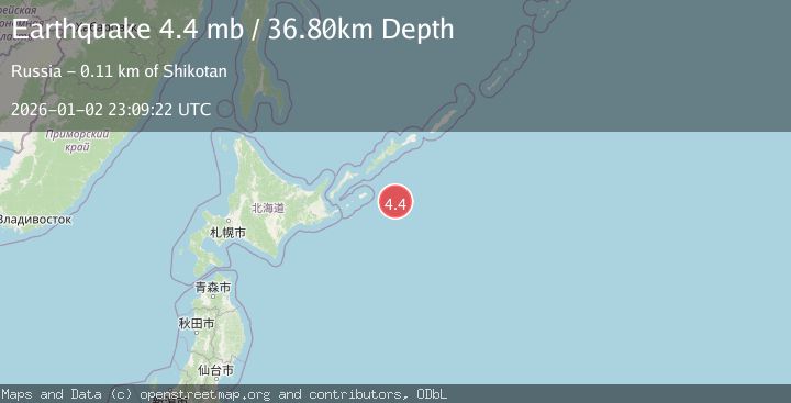
Earthquake EAST OF KURIL ISLANDS
Fri, 02 Jan 2026 23:09:22 GMT
Time1 month ago
Location
43.6418, 148.0595
Depth
36.8 KM
Event Summary
A 4.4 magnitude earthquake struck on EAST OF KURIL ISLANDS, at Fri, 02 Jan 2026 23:09:22 GMT. Depth: 36.8km. Reviewed by NEIC seismologists, this light quake occurred at a magnitude type of mb.
Magnitude
4.4
mb
Source
NEIC
Intensity
-
Agency Reports
1 Sources| Source | Magnitude | Depth | Time |
|---|---|---|---|
| NEICPrimary | 4.4 | 37 km | 1 month ago |
Earthquake Details
AutomaticEvent IDemsc_NEIC_20260102_0000376
Tsunami PotentialNo
Magnitude Typemb
Nearest Places
- 94.1 km
- 94.3 km
- 94.3 km
- 94.7 km
- 94.8 km
Comments
Join the discussion about this event.
Latest Earthquakes
2.4Mag
Queensland, Australia
Time3 minutes ago
Depth0.12 km
SourceVYT (Automatic)
1.5Mag
Southern California
Time6 minutes ago
Depth7.20 km
SourceVYT (Automatic)
3.1Mag
Southern Alaska
Time10 minutes ago
Depth108.28 km
SourceVYT (Automatic)
2.0Mag
13 km SSE of Volcano, Hawaii
Time11 minutes ago
Depth1.60 km
SourceUSGS (Automatic)
1.8Mag
9 km WNW of The Geysers, CA
Time13 minutes ago
Depth2.36 km
SourceUSGS (Automatic)
Nearby Earthquakes
4.9Mag
KURIL ISLANDS
Time1 month ago
Depth31.00 km
SourceEMSC (Automatic)
5.2Mag
KURIL ISLANDS
Time2 months ago
Depth10.00 km
SourceEMSC (Automatic)
4.9Mag
EAST OF KURIL ISLANDS
Time1 month ago
Depth7.90 km
SourceEMSC (Automatic)
5.9Mag
EAST OF KURIL ISLANDS
Time3 years ago
Depth53.00 km
SourceEMSC (Automatic)
5.7Mag
EAST OF KURIL ISLANDS
Time6 years ago
Depth44.00 km
SourceEMSC (Automatic)