Earthquake AZORES ISLANDS REGION
Mon, 16 Feb 2026 02:35:41 GMT
Time2 days ago
Location
36.8980, -24.2680
Depth
5.0 KM
Event Summary
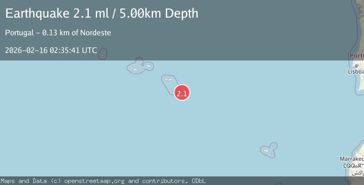
A 2.1 magnitude earthquake struck on AZORES ISLANDS REGION, at Mon, 16 Feb 2026 02:35:41 GMT. Depth: 5km. Reviewed by PDA seismologists, this minor quake occurred at a magnitude type of ml.
Magnitude
2.1
ml
Source
PDA
Intensity
-
Agency Reports
1 Sources| Source | Magnitude | Depth | Time |
|---|---|---|---|
| PDAPrimary | 2.1 | 5 km | 2 days ago |
Earthquake Details
AutomaticEvent IDemsc_PDA_20260216_0000033
Tsunami PotentialNo
Magnitude Typeml
Nearest Places
- Ilhéus das Formigas61.4 km
- Baixa do Maía66.0 km
- Ponta do Castelo66.4 km
- Maía66.5 km
- Farol de Gonçalo Velho66.6 km
Comments
Join the discussion about this event.
Latest Earthquakes
1.7Mag
Kenai Peninsula, Alaska
Time1 hour ago
Depth28.44 km
SourceVYT (Automatic)
1.7Mag
Tarapaca, Chile
Time1 hour ago
Depth6.47 km
SourceVYT (Automatic)
1.9Mag
Central Alaska
Time1 hour ago
Depth81.18 km
SourceVYT (Automatic)
1.2Mag
21 km ENE of Little Lake, CA
Time1 hour ago
Depth0.90 km
SourceUSGS (Automatic)
2.6Mag
ANTOFAGASTA, CHILE
Time1 hour ago
Depth101.50 km
SourceCSN (Automatic)
Nearby Earthquakes
5.1Mag
AZORES ISLANDS REGION
Time5 years ago
Depth20.00 km
SourceEMSC (Automatic)
3.0Mag
AZORES ISLANDS REGION
Time15 years ago
Depth10.00 km
SourceEMSC (Automatic)
3.0Mag
AZORES ISLANDS REGION
Time2 years ago
Depth10.00 km
SourcePDA (Automatic)
3.0Mag
AZORES ISLANDS REGION
Time5 years ago
Depth5.00 km
SourcePDA (Automatic)
3.0Mag
AZORES ISLANDS REGION
Time14 years ago
Depth5.00 km
SourceEMSC (Automatic)