Earthquake AZORES ISLANDS REGION
Thu, 19 Feb 2026 17:18:03 GMT
Time1 hour ago
Location
37.3180, -24.7270
Depth
10.4 KM
Event Summary
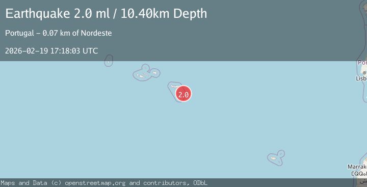
A 2.0 magnitude earthquake struck on AZORES ISLANDS REGION, at Thu, 19 Feb 2026 17:18:03 GMT. Depth: 10.4km. Reviewed by PDA seismologists, this minor quake occurred at a magnitude type of ml.
Magnitude
2.0
ml
Source
PDA
Intensity
-
Agency Reports
1 Sources| Source | Magnitude | Depth | Time |
|---|---|---|---|
| PDAPrimary | 2.0 | 10 km | 1 hour ago |
Earthquake Details
AutomaticEvent IDemsc_PDA_20260219_0000261
Tsunami PotentialNo
Magnitude Typeml
Nearest Places
- Ilhéus das Formigas7.6 km
- Baixa de Fora43.4 km
- Ponta do Norte45.0 km
- Ponta do Mormo45.5 km
- Ilhéu de São Lourenço46.4 km
Comments
Join the discussion about this event.
Latest Earthquakes
3.2Mag
Croatia region
Time1 hour ago
Depth10.00 km
SourceVYT (Automatic)
3.6Mag
Serbia
Time1 hour ago
Depth688.35 km
SourceVYT (Automatic)
3.1Mag
NORTH ISLAND OF NEW ZEALAND
Time1 hour ago
Depth204.40 km
SourceGNS (Automatic)
2.2Mag
Andreanof Islands, Aleutian Islands, Alaska
Time1 hour ago
Depth130.98 km
SourceVYT (Automatic)
4.5Mag
Seram, Indonesia
Time1 hour ago
Depth297.85 km
SourceVYT (Automatic)
Nearby Earthquakes
5.9Mag
AZORES ISLANDS REGION
Time18 years ago
Depth8.60 km
SourceEMSC (Automatic)
3.0Mag
AZORES ISLANDS REGION
Time18 years ago
Depth5.00 km
SourceEMSC (Automatic)
3.0Mag
AZORES ISLANDS REGION
Time17 years ago
Depth5.00 km
SourceEMSC (Automatic)
3.0Mag
AZORES ISLANDS REGION
Time18 years ago
Depth0.00 km
SourceEMSC (Automatic)
3.0Mag
AZORES ISLANDS REGION
Time18 years ago
Depth10.00 km
SourceEMSC (Automatic)