Earthquake PHILIPPINE ISLANDS REGION
Thu, 12 Aug 2021 07:50:01 GMT
Time4 years ago
Location
5.7200, 127.4300
Depth
29.0 KM
Event Summary
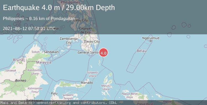
A 4.0 magnitude earthquake struck on PHILIPPINE ISLANDS REGION, at Thu, 12 Aug 2021 07:50:01 GMT. Depth: 29km. Reviewed by PIVS seismologists, this light quake occurred at a magnitude type of m.
Magnitude
4.0
m
Source
PIVS
Intensity
-
Agency Reports
1 Sources| Source | Magnitude | Depth | Time |
|---|---|---|---|
| PIVSPrimary | 4.0 | 29 km | 4 years ago |
Earthquake Details
AutomaticEvent IDemsc_PIVS_20210812_0000088
Tsunami PotentialNo
Magnitude Typem
Nearest Places
- Tanjung Dapapa94.6 km
- Desa Pulau Miangas95.4 km
- Kecamatan Miangas95.4 km
- Pulau Miangas95.4 km
- Pulau Baronto95.9 km
Comments
Join the discussion about this event.
Latest Earthquakes
1.0Mag
8 km WNW of The Geysers, CA
Time2 minutes ago
Depth0.69 km
SourceUSGS (Automatic)
2.3Mag
SAN FRANCISCO BAY AREA, CALIF.
Time5 minutes ago
Depth8.70 km
SourceNC (Automatic)
2.1Mag
WESTERN TEXAS
Time7 minutes ago
Depth0.00 km
SourceTX (Automatic)
1.9Mag
Tarapaca, Chile
Time11 minutes ago
Depth0.00 km
SourceVYT (Automatic)
1.0Mag
11 km SW of Anza, CA
Time14 minutes ago
Depth8.49 km
SourceUSGS (Automatic)
Nearby Earthquakes
3.0Mag
PHILIPPINE ISLANDS REGION
Time4 years ago
Depth33.00 km
SourcePIVS (Automatic)
5.0Mag
PHILIPPINE ISLANDS REGION
Time16 years ago
Depth60.00 km
SourceEMSC (Automatic)
5.0Mag
PHILIPPINE ISLANDS REGION
Time8 years ago
Depth40.00 km
SourceEMSC (Automatic)
5.7Mag
PHILIPPINE ISLANDS REGION
Time8 years ago
Depth10.00 km
SourceEMSC (Automatic)
5.2Mag
PHILIPPINE ISLANDS REGION
Time8 years ago
Depth10.00 km
SourceEMSC (Automatic)