Earthquake SAMAR, PHILIPPINES
Fri, 06 Feb 2026 20:00:12 GMT
Time1 month ago
Location
12.8900, 125.0200
Depth
13.0 KM
Event Summary
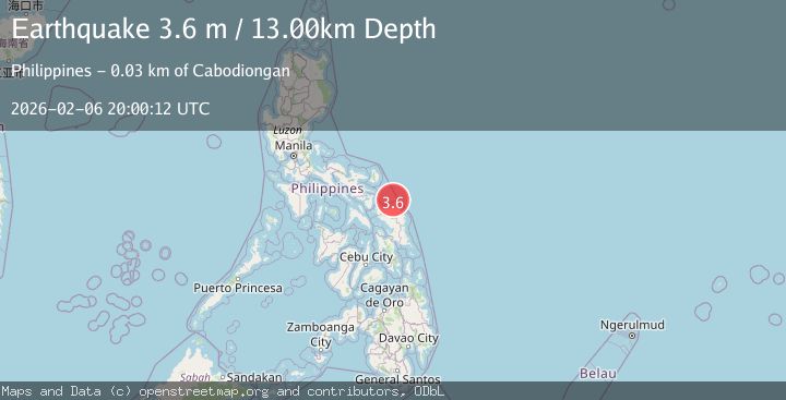
A 3.6 magnitude earthquake struck on SAMAR, PHILIPPINES, at Fri, 06 Feb 2026 20:00:12 GMT. Depth: 13km. Reviewed by PIVS seismologists, this minor quake occurred at a magnitude type of m.
Magnitude
3.6
m
Source
PIVS
Intensity
III
Agency Reports
1 Sources| Source | Magnitude | Depth | Time |
|---|---|---|---|
| PIVSPrimary | 3.6 | 13 km | 1 month ago |
Earthquake Details
AutomaticEvent IDemsc_PIVS_20260206_0000353
QualityS
Tsunami PotentialNo
Magnitude Typem
Last Update1 month ago
Nearest Places
Possibly felt by: 29.7K
- IIICabodiongan25.3 km3K people
- 30.6 km2.5K people
- IILaoang35.6 km16.7K people
- IIPangpang36.1 km2K people
- IIPambujan37.6 km10.8K people
- IIPalapag39.6 km8.3K people
- IIViga41.7 km2K people
- 43.0 km
- IIBantayan45.7 km4K people
- IICabatuan46.3 km2.4K people
- IIBugko46.5 km3.1K people
- IINenita50.1 km2.6K people
- 50.8 km5.2K people
- IIMapanas52.8 km3.6K people
- IICatubig53.5 km4.7K people
- IIMakiwalo54.3 km4.6K people
- IIAnito57.0 km2.1K people
- 60.1 km47.4K people
- 61.3 km3.4K people
- 63.7 km9.1K people
- 64.0 km4.8K people
- 65.9 km2.7K people
- 68.0 km2.5K people
- 68.7 km2.7K people
- 69.2 km2.6K people
- 69.9 km2.3K people
- 70.3 km
- 70.9 km3.7K people
- 71.2 km3.8K people
- IBiri74.8 km2.6K people
- 76.4 km
- 78.6 km2.5K people
- 81.1 km5K people
- 84.6 km4.1K people
- 85.5 km4.8K people
- 89.8 km2.1K people
- 90.7 km7.5K people
- 91.1 km
- 91.3 km2.7K people
- 91.4 km2.3K people
- 91.6 km2.2K people
- 92.9 km2.2K people
- 93.0 km5.8K people
- 93.1 km2.8K people
- 93.3 km
- IOras95.0 km9K people
- 95.1 km3.6K people
- 95.2 km3.3K people
- 95.8 km3.2K people
- 96.0 km2.8K people
- 96.3 km
- 96.9 km3.4K people
- 97.3 km14K people
Felt Reports0
Did you feel this earthquake? Report it to help others.
No reports yet
Be the first to report this earthquake!
Latest Earthquakes
Loading...
Nearby Earthquakes
5.1Mag
SAMAR, PHILIPPINES
Time0 months ago
Depth49.00 km
SourceEMSC (Automatic)
3.0Mag
SAMAR, PHILIPPINES
Time1 month ago
Depth21.00 km
SourcePIVS (Automatic)
3.0Mag
SAMAR, PHILIPPINES
Time1 month ago
Depth19.00 km
SourcePIVS (Automatic)
3.3Mag
SAMAR, PHILIPPINES
Time1 month ago
Depth24.00 km
SourcePIVS (Automatic)
3.2Mag
SAMAR, PHILIPPINES
Time2 months ago
Depth16.00 km
SourcePIVS (Automatic)