Earthquake MINDORO, PHILIPPINES
Mon, 09 Feb 2026 00:05:37 GMT
Time1 hour ago
Location
13.7600, 120.5600
Depth
111.0 KM
Event Summary
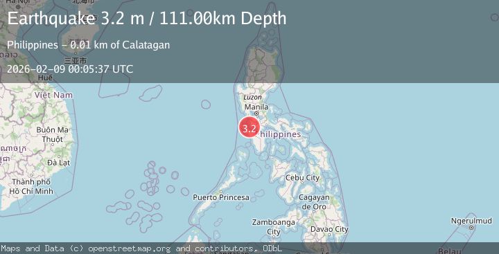
A 3.2 magnitude earthquake struck on MINDORO, PHILIPPINES, at Mon, 09 Feb 2026 00:05:37 GMT. Depth: 111km. Reviewed by PIVS seismologists, this minor quake occurred at a magnitude type of m.
Magnitude
3.2
m
Source
PIVS
Intensity
-
Agency Reports
1 Sources| Source | Magnitude | Depth | Time |
|---|---|---|---|
| PIVSPrimary | 3.2 | 111 km | 1 hour ago |
Earthquake Details
AutomaticEvent IDemsc_PIVS_20260209_0000002
Tsunami PotentialNo
Magnitude Typem
Nearest Places
- Calatagan Point8.8 km
- Palo Bandero Point8.9 km
- Caybungo Point9.1 km
- Palapat Point9.1 km
- Calumbuyan Island9.2 km
Comments
Join the discussion about this event.
Latest Earthquakes
2.7Mag
CRETE, GREECE
Time1 hour ago
Depth20.80 km
SourceNOA (Automatic)
1.5Mag
STRAIT OF GIBRALTAR
Time1 hour ago
Depth0.00 km
SourceIGN (Automatic)
3.3Mag
Java Sea
Time1 hour ago
Depth10.00 km
SourceBMKG (Automatic)
1.0Mag
16 km SW of Toms Place, CA
Time1 hour ago
Depth4.82 km
SourceUSGS (Automatic)
3.2Mag
Talaud Islands, Indonesia
Time1 hour ago
Depth13.19 km
SourceBMKG (Automatic)
Nearby Earthquakes
3.2Mag
MINDORO, PHILIPPINES
Time2 weeks ago
Depth73.00 km
SourcePIVS (Automatic)
3.0Mag
MINDORO, PHILIPPINES
Time1 week ago
Depth5.00 km
SourcePIVS (Automatic)
3.3Mag
LUZON, PHILIPPINES
Time2 weeks ago
Depth56.00 km
SourcePIVS (Automatic)
3.7Mag
LUZON, PHILIPPINES
Time3 days ago
Depth10.00 km
SourcePIVS (Automatic)
3.8Mag
PHILIPPINE ISLANDS REGION
Time4 days ago
Depth12.00 km
SourcePIVS (Automatic)