Earthquake MORO GULF, MINDANAO, PHILIPPINES
Tue, 10 Feb 2026 01:04:00 GMT
Time5 months ago
Location
6.2100, 123.7200
Depth
35.0 KM
Event Summary
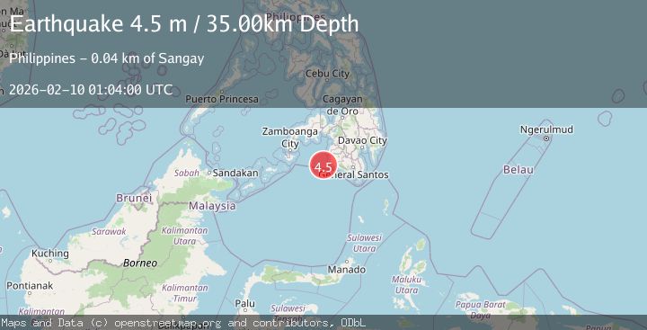
A 4.5 magnitude earthquake struck on MORO GULF, MINDANAO, PHILIPPINES, at Tue, 10 Feb 2026 01:04:00 GMT. Depth: 35km. Reviewed by PIVS seismologists, this light quake occurred at a magnitude type of m.
Magnitude
4.5
m
Source
PIVS
Intensity
III
Agency Reports
2 Sources| Source | Magnitude | Depth | Time |
|---|---|---|---|
| PIVSPrimary | 4.5 | 35 km | 5 months ago |
| NEIC | 4.5 | 10 km | 5 months ago+2s |
Earthquake Details
AutomaticEvent IDemsc_PIVS_20260210_0000015
QualityS
Tsunami PotentialNo
Magnitude Typem
Last Update4 months ago
Nearest Places
Possibly felt by: 773.5K
- IIISangay44.4 km3.8K people
- IIIKulaman49.2 km3.4K people
- IIIBantogon49.9 km5.4K people
- IIIPalimbang51.8 km4.9K people
- IIIKalamansig52.8 km12.8K people
- IIILimulan56.3 km3.9K people
- IIILebak61.5 km
- IIIPuloypuloy62.9 km5.1K people
- IIITaguisa64.5 km3.1K people
- IIINoling65.3 km3K people
- IIIPuricay65.5 km2.5K people
- IIIRagandang67.1 km2.2K people
- IIITran67.8 km2.2K people
- 69.1 km3K people
- 70.9 km4.5K people
- IIGadung73.8 km2.5K people
- IIBasak74.7 km3.8K people
- IIMaguling76.6 km2.4K people
- IIMindupok78.9 km3.4K people
- 84.0 km12.5K people
- IIMabay84.3 km3.2K people
- IIMaitum88.2 km8.5K people
- 92.1 km2.8K people
- IITapikan97.6 km2.2K people
- IINalus98.2 km3.9K people
- IIRimpeso99.8 km3.5K people
- IIKapaya100.2 km4.2K people
- IIBiwang101.1 km2.3K people
- 101.3 km2.2K people
- IITuka101.8 km4K people
- 102.7 km17.8K people
- IIBusok102.8 km3.5K people
- IIKiamba102.9 km11K people
- IIBlinsung103.3 km4.2K people
- IIUpi103.3 km9.4K people
- IIDaguma103.6 km3.8K people
- IIVillamor104.1 km2.4K people
- IIKolumbug104.2 km2.5K people
- IISatan105.2 km4.1K people
- 105.2 km6K people
- IIKauran105.3 km5.1K people
- IILapuz105.5 km2.6K people
- IIDukay105.5 km2.5K people
- IIPanay106.4 km4.1K people
- IILiberty106.5 km2.7K people
- IIDansuli106.7 km4.6K people
- 107.7 km4.5K people
- IIMaganoy108.0 km17.4K people
- 108.0 km2.3K people
- IIIsulan108.3 km31.7K people
- IITambilil108.6 km4.7K people
- 109.3 km3.7K people
- IINorala109.5 km12.8K people
- 109.5 km2.4K people
- 109.5 km21.8K people
- 110.0 km3.2K people
- IIAmpatuan110.2 km4K people
- 110.3 km3.8K people
- 110.9 km9.7K people
- IIBagan111.0 km2.2K people
- IITeresita111.5 km2.6K people
- 111.6 km4.7K people
- IIDahay111.8 km7.6K people
- IIMakir111.8 km2.4K people
- IIDinaig112.0 km
- 112.1 km5.4K people
- 112.4 km4.3K people
- IITalayan112.6 km
- 112.7 km3.1K people
- IIDumaguil112.8 km2.2K people
- IIDalican112.8 km13.9K people
- IISagasa113.3 km3.4K people
- IIKitapak113.6 km2.9K people
- IIKitango114.4 km2.6K people
- IILabuñgan114.4 km2.4K people
- IISurallah114.8 km31.1K people
- IITambak115.1 km2.3K people
- IIDadus115.3 km2.3K people
- 115.6 km2.2K people
- IIMaan116.4 km3.5K people
- IIGansing117.6 km5K people
- IITacurong118.5 km54.6K people
- IIAwang118.6 km8.4K people
- IIPagatin119.0 km3.1K people
- IIBañga119.4 km58.9K people
- 119.7 km
- IISadsalan119.9 km2.3K people
- IIMamali120.1 km2.4K people
- 120.3 km3.2K people
- 121.0 km4.3K people
- IISinolon121.0 km2.8K people
- IITaviran121.3 km2.9K people
- 121.5 km5.2K people
- IISampao121.9 km5.3K people
- 122.1 km3.4K people
- 122.3 km10.3K people
- IIMileb122.3 km2.8K people
- IILibas122.4 km2.2K people
- IILumuyon122.4 km3.8K people
- IILamba122.5 km6.4K people
- 122.6 km2.1K people
- IIT'boli123.1 km
- IIBarurao123.5 km3K people
- IIParaiso124.0 km4.2K people
- 124.0 km3.7K people
- IIDado124.1 km5.2K people
- 124.9 km3.3K people
- IILamian125.0 km3.9K people
- 125.1 km4.6K people
- IIMaibu125.2 km2.6K people
- 125.3 km2.5K people
- 125.4 km3.2K people
- 125.5 km8.2K people
- IIBongued125.7 km2.7K people
- 126.7 km31.1K people
- 126.8 km325.1K people
- 127.1 km4.3K people
- 127.1 km4.7K people
- 127.5 km3.9K people
- 127.6 km2.3K people
- 127.8 km4.2K people
- 127.9 km
- 128.2 km2.1K people
- 128.7 km195.4K people
- 128.8 km2.4K people
- 129.0 km9.4K people
- 129.5 km4.8K people
- 129.5 km2.3K people
- 129.9 km5.3K people
- 130.0 km3.9K people
- IGang130.0 km3.3K people
- 130.7 km2.2K people
- 131.0 km5.3K people
- 131.3 km6.7K people
- 131.5 km3.2K people
- 131.6 km2.7K people
- 132.0 km2.4K people
- 132.3 km28K people
- 132.6 km2.7K people
- 132.8 km2.9K people
- IBaka132.9 km2.4K people
- 133.1 km3.2K people
- 133.4 km6.8K people
- 133.5 km4K people
- 133.5 km2.5K people
- 134.4 km6.3K people
- 134.5 km2.2K people
- 134.7 km1.1M people
- 134.8 km3.2K people
- 135.2 km5.1K people
- 135.2 km4.7K people
- 135.3 km2.8K people
- 135.7 km2.8K people
- 135.9 km5K people
- 136.2 km1.3M people
- 136.2 km13.1K people
- 136.2 km2.2K people
- 136.4 km3K people
- 136.6 km3.4K people
- IGlad136.6 km5.7K people
- 136.8 km3.3K people
- ITupi137.0 km16.5K people
- 138.3 km6.5K people
- 138.7 km3.1K people
- IBual138.7 km2.9K people
- 139.3 km3.9K people
- 139.4 km5.4K people
- 139.5 km2.6K people
- 140.1 km2.2K people
- 140.2 km4.4K people
- 140.5 km2.3K people
- 140.6 km3.7K people
- 140.7 km4.4K people
- 141.0 km15K people
- 141.0 km3.2K people
- 141.1 km32.9K people
- 141.4 km2.1K people
- 141.6 km2.1K people
- 141.7 km2.4K people
- 141.8 km4K people
- 141.8 km2.3K people
- 142.0 km11.4K people
- 142.1 km2.2K people
- 142.6 km44.9K people
- 142.6 km2.3K people
- 142.7 km3.1K people
- 143.1 km2.9K people
- 143.2 km4.9K people
- 143.3 km3.8K people
- 143.5 km5.9K people
- 143.8 km5K people
- 143.9 km5.1K people
- 144.0 km4.6K people
- 144.7 km5.6K people
- 144.8 km3.1K people
- 145.0 km5.5K people
- 145.0 km3.2K people
- 145.3 km3.6K people
- 145.5 km9.6K people
- 145.6 km6K people
- 146.1 km2.3K people
- 146.7 km4.7K people
- IBual146.8 km4.7K people
- 146.8 km2.6K people
- 147.1 km5.2K people
- 147.5 km2.6K people
- 147.5 km5.8K people
- 147.9 km2.6K people
- 148.6 km64K people
- 149.3 km7.8K people
- 149.3 km2.3K people
- 149.5 km3K people
- 149.7 km4K people
- 149.8 km6.7K people
- 150.2 km2.9K people
- 150.3 km3K people
- 150.3 km11K people
- 150.5 km4.8K people
- 150.9 km4.5K people
- 151.8 km2.4K people
- 152.1 km4.3K people
- 152.7 km2.4K people
- 152.8 km2.6K people
- 153.2 km4.4K people
- 153.6 km3.7K people
- 153.8 km9K people
- IPolo154.0 km2.6K people
- INuyo154.5 km2.2K people
- 154.9 km3.8K people
- 154.9 km7.9K people
- 155.0 km8.6K people
- 155.2 km2.2K people
- 155.8 km3.7K people
- 155.8 km7.1K people
- 155.9 km2.5K people
- 156.0 km5K people
- 156.7 km3K people
- 156.8 km
- 157.1 km2.5K people
- 157.2 km5.1K people
- 157.3 km2.8K people
- 157.6 km3.1K people
- 157.9 km31.8K people
- 158.3 km4.4K people
- 158.8 km3.3K people
- 159.3 km2.2K people
- 160.5 km2.1K people
- 160.6 km2.3K people
- 160.8 km697.3K people
- 161.3 km2.3K people
- 161.4 km
- 162.0 km8.8K people
- 162.2 km8.5K people
- 162.8 km9.8K people
- 162.8 km2.8K people
- 163.1 km2.7K people
- 163.3 km2.4K people
- 163.4 km3.3K people
- 163.9 km14.6K people
- 164.5 km3.1K people
- 164.8 km4K people
- 164.8 km2.1K people
- 165.5 km3.1K people
- 165.8 km3.4K people
- 166.0 km2.8K people
- 166.0 km2.1K people
- 166.0 km8.5K people
- 166.7 km4.9K people
- 166.9 km4.8K people
- 166.9 km8.2K people
- 167.1 km4.5K people
- 167.6 km2.7K people
- 167.8 km14.6K people
- IBau167.9 km6.7K people
- IAmas168.4 km6.2K people
- 168.5 km5.8K people
- 168.8 km3.8K people
- 169.0 km5.3K people
- 169.2 km3.3K people
- 169.2 km12.9K people
- 169.3 km3.4K people
- 169.4 km2.1K people
- IGlan169.6 km24.3K people
- 170.1 km2.1K people
- 170.3 km2.7K people
- 170.3 km3.7K people
- 170.5 km2.3K people
- 171.3 km2.5K people
- 171.3 km2.9K people
- 172.3 km3.2K people
- 172.7 km5.1K people
- 172.8 km52.2K people
- 173.0 km13.8K people
- 173.1 km2.2K people
- 173.1 km16.6K people
- 173.1 km4K people
- 173.4 km3.4K people
- 173.5 km4.5K people
- 174.0 km11.5K people
- 174.0 km43.3K people
- 174.1 km9.8K people
- 174.1 km4.5K people
- 174.4 km4.2K people
- 174.5 km3K people
- 174.8 km2.5K people
- 174.8 km2.2K people
- 175.2 km3K people
- 175.3 km8.5K people
- 175.3 km2.9K people
- 175.4 km79.7K people
- 175.4 km2.1K people
- 175.5 km5.8K people
- 175.6 km19.4K people
- IDolo175.8 km4K people
- 175.8 km5.9K people
- 175.8 km3.7K people
- 176.3 km
- 176.3 km5.3K people
- 176.8 km4.3K people
- 177.0 km21.4K people
- 177.0 km2.3K people
- 177.2 km4.8K people
- 177.4 km7.2K people
- 177.6 km3.3K people
- 178.2 km4.1K people
- 179.2 km4K people
- 179.3 km2.6K people
- 179.4 km2.4K people
- 180.0 km
- 180.2 km2.3K people
- 180.2 km6K people
- 180.5 km5.7K people
- 180.8 km5.6K people
- 181.1 km10.9K people
- 181.1 km3.5K people
- 181.2 km2.7K people
- 181.5 km10.6K people
- 181.5 km3K people
- 181.6 km3.5K people
- 181.7 km5.3K people
- 181.8 km132.1K people
- 182.1 km3.2K people
- 182.1 km3.2K people
- 182.3 km186.9K people
- 182.4 km6.9K people
- 182.4 km6.1K people
- 182.7 km2.3K people
- 182.8 km
- 182.8 km4.5K people
- 183.1 km4K people
- 183.1 km3.5K people
- 183.2 km5.4K people
- 183.3 km13.1K people
- 183.5 km4.7K people
- 183.5 km6.2K people
- 183.7 km2.8K people
- IBuug184.0 km8.6K people
- 184.3 km4.9K people
- 184.3 km3.8K people
- 184.5 km6.6K people
- 184.6 km3.3K people
- 184.7 km2.4K people
- 184.9 km7.2K people
- 184.9 km
- 185.0 km7.4K people
- 185.5 km
- 185.5 km10.8K people
- 185.6 km4.3K people
- 185.8 km11.4K people
- 186.0 km2.2K people
- 186.2 km
- 186.2 km2.2K people
- 186.3 km4.8K people
- 187.0 km3.8K people
- 187.2 km2.7K people
- 187.2 km2.6K people
- 187.4 km2.5K people
- 187.5 km2.2K people
- 187.7 km3.5K people
- 187.9 km4.3K people
- 187.9 km12.5K people
- 188.0 km9.7K people
- 188.1 km
- IGoma188.3 km4.3K people
- 188.7 km2.5K people
- 188.8 km7.3K people
- 189.0 km2.8K people
- IRebe189.1 km4.4K people
- 189.3 km3.6K people
- 189.8 km2.1K people
- 189.9 km
- 190.4 km8.3K people
- ISiay190.4 km2.4K people
- 190.4 km6.2K people
- 190.5 km3.5K people
- 190.6 km116.1K people
- 190.7 km4.3K people
- 190.8 km13.7K people
- 191.0 km2.7K people
- 191.1 km5.2K people
- 191.5 km3.6K people
- 191.6 km2.3K people
- 192.1 km4.4K people
- 192.1 km4.5K people
- 192.5 km3.5K people
- 192.5 km8.7K people
- 192.6 km2.5K people
- 192.7 km2.6K people
- 193.0 km6.5K people
- 193.0 km14.7K people
- 193.8 km5.9K people
- 194.1 km2.3K people
- 194.1 km9.2K people
- 194.2 km4.1K people
- IWao194.3 km17.8K people
- 194.7 km3.7K people
- 194.9 km2.7K people
- 195.3 km2.9K people
- 195.5 km6.7K people
- 195.5 km2.2K people
- 195.6 km2.4K people
- 195.7 km8.8K people
- ILala196.1 km9.3K people
- 196.3 km3.2K people
- 196.4 km5.2K people
- 196.7 km3.3K people
- 197.0 km4.9K people
- 197.0 km
- 197.2 km16.8K people
- 197.3 km3K people
- 197.6 km2.4K people
- 197.7 km3.5K people
- IBatu197.8 km3K people
- 197.8 km457.6K people
- 197.8 km4.3K people
- 197.9 km6.1K people
- 198.0 km6.8K people
- 198.1 km2.7K people
- IMuti198.3 km2.3K people
- 198.6 km6.4K people
- 199.0 km3.1K people
- 199.0 km2.2K people
- 199.5 km2.2K people
- 199.6 km
- 200.0 km2.1K people
- 200.3 km2.6K people
- 200.5 km2.4K people
- 200.6 km2.4K people
- 200.6 km4.9K people
- 200.9 km67.3K people
- 201.3 km2.4K people
- 201.4 km2.1K people
- 201.6 km3.6K people
- 201.9 km3.7K people
- 202.0 km3.2K people
- 202.0 km2.8K people
- 202.1 km3.2K people
- 202.8 km7K people
- 202.9 km2.3K people
- 203.7 km4K people
- INaga203.8 km8.5K people
- 203.9 km2.9K people
- 204.0 km4.3K people
- 204.1 km9.7K people
- 204.4 km4.4K people
- 204.4 km
- 204.9 km2.2K people
- 204.9 km14.5K people
- 205.0 km6.9K people
- 205.0 km3.6K people
- 205.1 km2.9K people
- 205.2 km
- 205.2 km
- 205.2 km4.1K people
- 205.4 km11K people
- 205.4 km7.3K people
- 205.4 km2.1K people
- 205.4 km2.1K people
- 205.6 km
- 205.7 km3.2K people
- 205.9 km5.1K people
- 205.9 km29.7K people
- 206.4 km4.6K people
- 206.5 km4.2K people
- 206.7 km2.7K people
- 206.8 km10.7K people
- 207.2 km2.8K people
- 207.2 km31.4K people
- 207.4 km3.6K people
- 207.6 km
- 207.8 km7.5K people
- 208.4 km5.5K people
- 208.6 km9K people
- 208.6 km
- 208.7 km
- 208.9 km2.7K people
- 208.9 km143.6K people
Felt Reports0
Did you feel this earthquake? Report it to help others.
No reports yet
Be the first to report this earthquake!
Latest Earthquakes
Loading...
Nearby Earthquakes
3.0Mag
MORO GULF, MINDANAO, PHILIPPINES
Time1 week ago
Depth9.00 km
SourcePIVS (Automatic)
3.2Mag
MORO GULF, MINDANAO, PHILIPPINES
Time1 week ago
Depth2.00 km
SourcePIVS (Automatic)
3.7Mag
MINDANAO, PHILIPPINES
Time2 weeks ago
Depth7.00 km
SourcePIVS (Automatic)
4.4Mag
Mindanao, Philippines
Time3 weeks ago
Depth407.14 km
SourceBMKG
3.6Mag
MORO GULF, MINDANAO, PHILIPPINES
Time3 weeks ago
Depth384.00 km
SourcePIVS (Automatic)