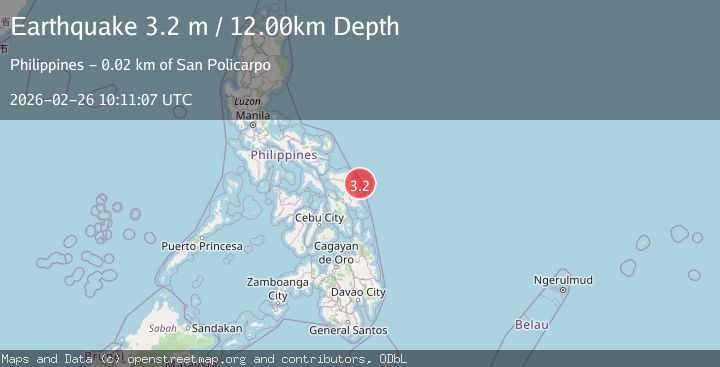
Earthquake SAMAR, PHILIPPINES
Thu, 26 Feb 2026 10:11:07 GMT
Time1 hour ago
Location
12.1200, 125.6900
Depth
12.0 KM
Event Summary
A 3.2 magnitude earthquake struck on SAMAR, PHILIPPINES, at Thu, 26 Feb 2026 10:11:07 GMT. Depth: 12km. Reviewed by PIVS seismologists, this minor quake occurred at a magnitude type of m.
Magnitude
3.2
m
Source
PIVS
Intensity
-
Agency Reports
1 Sources| Source | Magnitude | Depth | Time |
|---|---|---|---|
| PIVSPrimary | 3.2 | 12 km | 1 hour ago |
Earthquake Details
AutomaticEvent IDemsc_PIVS_20260226_0000153
Tsunami PotentialNo
Magnitude Typem
Nearest Places
- 13.4 km
- 13.5 km
- 14.0 km
- 14.0 km
- 14.1 km
Comments
Join the discussion about this event.
Latest Earthquakes
2.7Mag
near the coast of southern Peru
Time1 hour ago
Depth90.58 km
SourceVYT (Automatic)
2.5Mag
Flores Sea
Time1 hour ago
Depth26.00 km
SourceBMKG
3.4Mag
Tarapaca, Chile
Time1 hour ago
Depth109.01 km
SourceVYT (Automatic)
1.7Mag
7 km S of Volcano, Hawaii
Time1 hour ago
Depth27.92 km
SourceUSGS (Automatic)
1.9Mag
23 km SE of Naalehu, Hawaii
Time1 hour ago
Depth41.25 km
SourceUSGS (Automatic)
Nearby Earthquakes
5.3Mag
SAMAR, PHILIPPINES
Time17 years ago
Depth80.00 km
SourceEMSC (Automatic)
3.0Mag
SAMAR, PHILIPPINES
Time3 years ago
Depth16.00 km
SourcePIVS (Automatic)
5.0Mag
SAMAR, PHILIPPINES
Time13 years ago
Depth100.00 km
SourceEMSC (Automatic)
3.3Mag
SAMAR, PHILIPPINES
Time3 days ago
Depth12.00 km
SourcePIVS (Automatic)
5.2Mag
SAMAR, PHILIPPINES
Time12 years ago
Depth80.00 km
SourceEMSC (Automatic)