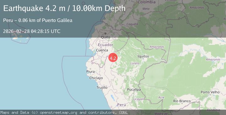
Earthquake PERU-ECUADOR BORDER REGION
Sat, 28 Feb 2026 04:28:15 GMT
Time4 months ago
Location
-3.6000, -77.4600
Depth
10.0 KM
Event Summary
A 4.2 magnitude earthquake struck on PERU-ECUADOR BORDER REGION, at Sat, 28 Feb 2026 04:28:15 GMT. Depth: 10km. Reviewed by QUI seismologists, this light quake occurred at a magnitude type of m.
Magnitude
4.2
m
Source
QUI
Intensity
II
Agency Reports
2 Sources| Source | Magnitude | Depth | Time |
|---|---|---|---|
| QUIPrimary | 4.2 | 10 km | 4 months ago |
| EMSC | 4.2 | 59 km | 4 months ago+2s |
Earthquake Details
AutomaticEvent IDemsc_QUI_20260228_0000053
QualityS
Tsunami PotentialNo
Magnitude Typem
Last Update4 months ago
Nearest Places
Possibly felt by: 1.7K
- 60.7 km
- 107.5 km
- 114.7 km471 people
- 126.4 km4.6K people
- 140.1 km
- 146.6 km10K people
- 149.5 km7.4K people
Felt Reports0
Did you feel this earthquake? Report it to help others.
No reports yet
Be the first to report this earthquake!
Latest Earthquakes
Loading...
Nearby Earthquakes
3.6Mag
NORTHERN PERU
Time2 weeks ago
Depth138.00 km
SourceQUI (Automatic)
3.6Mag
NORTHERN PERU
Time1 month ago
Depth15.00 km
SourceLIM (Automatic)
3.7Mag
PERU-ECUADOR BORDER REGION
Time1 month ago
Depth130.00 km
SourceQUI (Automatic)
5.2Mag
Peru-Ecuador border region
Time2 months ago
Depth10.00 km
SourceVYT (Automatic)
3.6Mag
Peru-Ecuador border region
Time2 months ago
Depth163.94 km
SourceVYT (Automatic)