Earthquake MYANMAR
Fri, 16 Jan 2026 07:55:25 GMT
Time6 months ago
Location
17.3930, 96.2090
Depth
10.0 KM
Event Summary
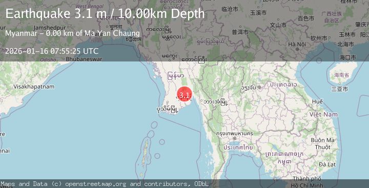
A 3.1 magnitude earthquake struck on MYANMAR, at Fri, 16 Jan 2026 07:55:25 GMT. Depth: 10km. Reviewed by TSB seismologists, this minor quake occurred at a magnitude type of m.
Magnitude
3.1
m
Source
TSB
Intensity
III
Agency Reports
1 Sources| Source | Magnitude | Depth | Time |
|---|---|---|---|
| TSBPrimary | 3.1 | 10 km | 6 months ago |
Earthquake Details
AutomaticEvent IDemsc_TSB_20260116_0000127
QualityS
Tsunami PotentialNo
Magnitude Typem
Last Update5 months ago
Nearest Places
Possibly felt by: 44.3K
- IIBago29.6 km244.4K people
- 37.1 km
- 40.5 km38.1K people
- 53.2 km54.4K people
Felt Reports0
Did you feel this earthquake? Report it to help others.
No reports yet
Be the first to report this earthquake!
Latest Earthquakes
Loading...
Nearby Earthquakes
3.9Mag
MYANMAR
Time2 weeks ago
Depth10.00 km
SourceTSB (Automatic)
3.5Mag
NEAR SOUTH COAST OF MYANMAR
Time3 weeks ago
Depth10.00 km
SourceTSB (Automatic)
3.1Mag
NEAR SOUTH COAST OF MYANMAR
Time2 months ago
Depth10.00 km
SourceTSB (Automatic)
3.8Mag
NEAR SOUTH COAST OF MYANMAR
Time2 months ago
Depth10.00 km
SourceTSB (Automatic)
3.7Mag
NEAR SOUTH COAST OF MYANMAR
Time2 months ago
Depth10.00 km
SourceTSB (Automatic)