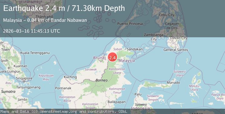
Earthquake SABAH-KALIMANTAN BORDER REGION
Mon, 16 Mar 2026 11:45:13 GMT
Time3 weeks ago
Location
4.7349, 116.3224
Depth
71.3 KM
Event Summary
A 2.4 magnitude earthquake struck on SABAH-KALIMANTAN BORDER REGION, at Mon, 16 Mar 2026 11:45:13 GMT. Depth: 71.3km. Reviewed by MMD seismologists, this minor quake occurred at a magnitude type of m.
Magnitude
2.4
m
Source
MMD
Intensity
-
Agency Reports
1 Sources| Source | Magnitude | Depth | Time |
|---|---|---|---|
| MMDPrimary | 2.4 | 71 km | 3 weeks ago |
Earthquake Details
AutomaticEvent IDemsc_mmd_20260316_0000178
QualityS
Tsunami PotentialNo
Magnitude Typem
Last Update3 weeks ago
Felt Reports0
Did you feel this earthquake? Report it to help others.
No reports yet
Be the first to report this earthquake!
Latest Earthquakes
Loading...