Earthquake MORO GULF, MINDANAO, PHILIPPINES
Mon, 30 Mar 2026 03:48:42 GMT
Time1 week ago
Location
6.4500, 123.8200
Depth
2.0 KM
Event Summary
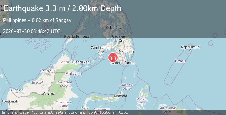
A 3.3 magnitude earthquake struck on MORO GULF, MINDANAO, PHILIPPINES, at Mon, 30 Mar 2026 03:48:42 GMT. Depth: 2km. Reviewed by PIVS seismologists, this minor quake occurred at a magnitude type of m.
Magnitude
3.3
m
Source
PIVS
Intensity
II
Agency Reports
1 Sources| Source | Magnitude | Depth | Time |
|---|---|---|---|
| PIVSPrimary | 3.3 | 2 km | 1 week ago |
Earthquake Details
AutomaticEvent IDemsc_pivs_20260330_0000053
QualityS
Tsunami PotentialNo
Magnitude Typem
Last Update1 week ago
Nearest Places
Possibly felt by: 12.3K
- IISangay24.8 km3.8K people
- IIBantogon25.3 km5.4K people
- 27.9 km12.8K people
- IIKulaman29.6 km3.4K people
- IILimulan30.7 km3.9K people
- IILebak34.7 km
- IITaguisa36.5 km3.1K people
- 36.8 km5.1K people
- IIPuricay38.1 km2.5K people
- IINoling38.7 km3K people
- IITran39.7 km2.2K people
- 40.9 km2.2K people
- 41.2 km3K people
- 45.0 km2.5K people
- 47.9 km3.8K people
- 48.7 km4.9K people
- 56.1 km12.5K people
- 68.6 km2.8K people
- 69.6 km4.5K people
- 70.9 km3.5K people
- 71.3 km2.2K people
Felt Reports0
Did you feel this earthquake? Report it to help others.
No reports yet
Be the first to report this earthquake!
Latest Earthquakes
Loading...
Nearby Earthquakes
3.1Mag
MINDANAO, PHILIPPINES
Time2 weeks ago
Depth8.00 km
SourcePIVS (Automatic)
3.6Mag
MORO GULF, MINDANAO, PHILIPPINES
Time3 weeks ago
Depth15.00 km
SourcePIVS (Automatic)
3.0Mag
MORO GULF, MINDANAO, PHILIPPINES
Time1 month ago
Depth17.00 km
SourcePIVS (Automatic)
3.4Mag
MORO GULF, MINDANAO, PHILIPPINES
Time1 month ago
Depth4.00 km
SourcePIVS (Automatic)
3.1Mag
MORO GULF, MINDANAO, PHILIPPINES
Time1 month ago
Depth28.00 km
SourcePIVS (Automatic)