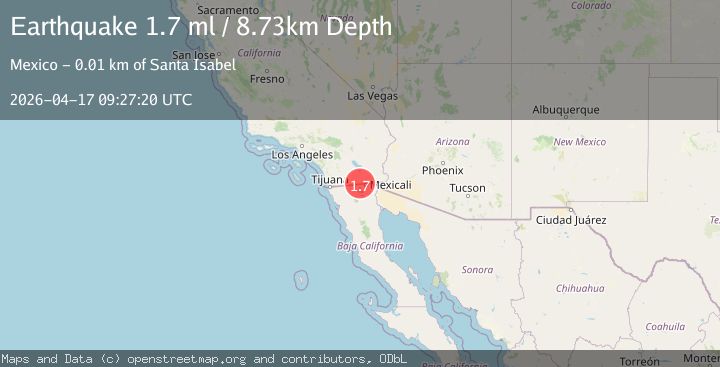
Earthquake 12 km NW of Progreso, B.C., MX
Fri, 17 Apr 2026 09:27:20 GMT
Time2 days ago
Location
32.6648, -115.6688
Depth
8.7 KM
Event Summary
A 1.7 magnitude earthquake struck on 12 km NW of Progreso, B.C., MX, at Fri, 17 Apr 2026 09:27:20 GMT. Depth: 8.72999954223633km. Reviewed by USGS seismologists, this minor quake occurred at a magnitude type of ml.
Magnitude
1.7
ml
Source
USGS
Intensity
-
Agency Reports
1 Sources| Source | Magnitude | Depth | Time |
|---|---|---|---|
| USGSPrimary | 1.7 | 9 km | 2 days ago |
Earthquake Details
AutomaticEvent IDusgs_ci41443288
QualityS
Tsunami PotentialNo
Magnitude Typeml
Last Update2 days ago
Used Stations36
Felt Reports0
Did you feel this earthquake? Report it to help others.
No reports yet
Be the first to report this earthquake!
Latest Earthquakes
Loading...
Nearby Earthquakes
1.0Mag
27 km ENE of Pine Valley, CA
Time21 hours ago
Depth9.09 km
SourceUSGS (Automatic)
1.8Mag
9 km SE of Puebla, B.C., MX
Time21 hours ago
Depth16.47 km
SourceUSGS (Automatic)
1.8Mag
31 km NNE of Ensenada, B.C., MX
Time22 hours ago
Depth9.35 km
SourceUSGS (Automatic)
1.5Mag
9 km ENE of Ocotillo Wells, CA
Time23 hours ago
Depth3.55 km
SourceUSGS (Automatic)
1.5Mag
1 km SW of Brawley, CA
Time1 day ago
Depth6.17 km
SourceUSGS (Automatic)