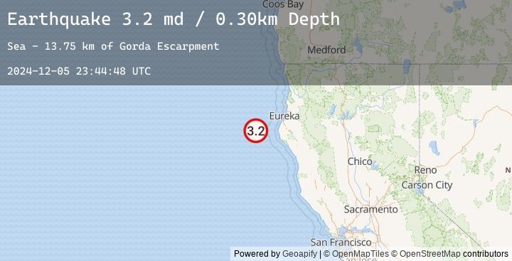
Earthquake 66 km WNW of Petrolia, CA
Thu, 05 Dec 2024 23:44:48 GMT
Time
1 year ago
Location
40.4515, -125.0488
Depth
0.3 KM
Event Summary
A 3.2 magnitude earthquake struck on 66 km WNW of Petrolia, CA, at Thu, 05 Dec 2024 23:44:48 GMT. Depth: 0.300000011920929km. Reviewed by USGS seismologists, this minor quake occurred at a magnitude type of md.
Magnitude
3.2
md
Source
USGS
Intensity
-
Earthquake Details
AutomaticEvent IDusgs_nc75096746
Tsunami PotentialNo
Magnitude Typemd
Nearest Places
- Gorda Escarpment13.7 km
- Bear Valley25.5 km
- Eel Fan29.1 km
- Mendocino Canyon38.6 km
- Eel Canyon45.1 km
Comments
Join the discussion about this event.
Latest Earthquakes
2.8Mag
Java, Indonesia
Time
23 minutes ago
Depth11.39 km
SourceBMKG (Automatic)
2.9Mag
Java, Indonesia
Time
25 minutes ago
Depth18.75 km
SourceBMKG (Automatic)
2.2Mag
WESTERN TURKEY
Time
32 minutes ago
Depth7.00 km
SourceEMSC (Automatic)
3.3Mag
LOMBOK REGION, INDONESIA
Time
38 minutes ago
Depth26.00 km
SourceEMSC (Automatic)
3.4Mag
Sumbawa Region, Indonesia
Time
38 minutes ago
Depth10.00 km
SourceBMKG (Automatic)