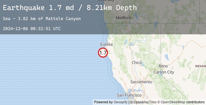
Earthquake 13 km W of Petrolia, CA
Fri, 06 Dec 2024 00:32:51 GMT
Time
1 year ago
Location
40.3155, -124.4345
Depth
8.2 KM
Event Summary
A 1.7 magnitude earthquake struck on 13 km W of Petrolia, CA, at Fri, 06 Dec 2024 00:32:51 GMT. Depth: 8.21000003814697km. Reviewed by USGS seismologists, this minor quake occurred at a magnitude type of md.
Magnitude
1.7
md
Source
USGS
Intensity
-
Earthquake Details
AutomaticEvent IDusgs_nc75096836
Tsunami PotentialNo
Magnitude Typemd
Nearest Places
- Mattole Canyon3.8 km
- Mendocino Canyon5.8 km
- The Brothers6.1 km
- Three Brothers6.6 km
- Mussel Rock6.7 km
Comments
Join the discussion about this event.
Latest Earthquakes
2.5Mag
Timor Region
Time
14 minutes ago
Depth25.10 km
SourceBMKG (Automatic)
2.3Mag
Sulawesi, Indonesia
Time
17 minutes ago
Depth19.58 km
SourceBMKG (Automatic)
2.8Mag
Northern Molucca Sea
Time
29 minutes ago
Depth195.30 km
SourceBMKG (Automatic)
2.2Mag
Sumbawa Region, Indonesia
Time
30 minutes ago
Depth212.77 km
SourceBMKG (Automatic)
3.4Mag
Near North Coast of West Papua
Time
35 minutes ago
Depth19.44 km
SourceBMKG (Automatic)
Nearby Earthquakes
No significant earthquakes nearby recently.