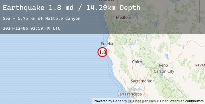
Earthquake 19 km W of Petrolia, CA
Fri, 06 Dec 2024 03:59:44 GMT
Time
1 year ago
Location
40.3073, -124.5100
Depth
14.3 KM
Event Summary
A 1.8 magnitude earthquake struck on 19 km W of Petrolia, CA, at Fri, 06 Dec 2024 03:59:44 GMT. Depth: 14.289999961853km. Reviewed by USGS seismologists, this minor quake occurred at a magnitude type of md.
Magnitude
1.8
md
Source
USGS
Intensity
-
Earthquake Details
AutomaticEvent IDusgs_nc75097106
Tsunami PotentialNo
Magnitude Typemd
Nearest Places
- Mattole Canyon5.8 km
- Mendocino Canyon8.3 km
- Mendocino Canyon10.5 km
- Christmas Rock12.1 km
- The Brothers12.5 km
Comments
Join the discussion about this event.
Latest Earthquakes
2.8Mag
Java, Indonesia
Time
26 minutes ago
Depth11.39 km
SourceBMKG (Automatic)
2.9Mag
Java, Indonesia
Time
28 minutes ago
Depth18.75 km
SourceBMKG (Automatic)
2.2Mag
WESTERN TURKEY
Time
34 minutes ago
Depth7.00 km
SourceEMSC (Automatic)
3.3Mag
LOMBOK REGION, INDONESIA
Time
40 minutes ago
Depth26.00 km
SourceEMSC (Automatic)
3.4Mag
Sumbawa Region, Indonesia
Time
40 minutes ago
Depth10.00 km
SourceBMKG (Automatic)