Earthquake 52 km WNW of Petrolia, CA
Fri, 13 Jun 2025 07:44:46 GMT
Time
6 months ago
Location
40.3363, -124.8958
Depth
2.2 KM
Event Summary
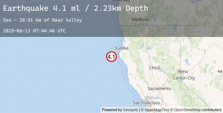
A 4.1 magnitude earthquake struck on 52 km WNW of Petrolia, CA, at Fri, 13 Jun 2025 07:44:46 GMT. Depth: 2.23000001907349km. Reviewed by USGS seismologists, this light quake occurred at a magnitude type of ml.
Magnitude
4.1
ml
Source
USGS
Intensity
-
Earthquake Details
AutomaticEvent IDusgs_nc75195021
Tsunami PotentialNo
Magnitude Typeml
Nearest Places
- Bear Valley20.5 km
- Gorda Escarpment23.2 km
- Mendocino Canyon24.6 km
- Blunts Reef Coast Guard Station35.2 km
- Blunts Reef Lightship (historical)35.8 km
Comments
Join the discussion about this event.
Latest Earthquakes
2.7Mag
Java, Indonesia
Time
27 minutes ago
Depth11.89 km
SourceBMKG (Automatic)
2.7Mag
SAN JUAN, ARGENTINA
Time
35 minutes ago
Depth10.00 km
SourceEMSC (Automatic)
2.1Mag
Java, Indonesia
Time
40 minutes ago
Depth21.53 km
SourceBMKG (Automatic)
2.7Mag
WESTERN TURKEY
Time
45 minutes ago
Depth11.70 km
SourceEMSC (Automatic)
2.9Mag
SAN JUAN, ARGENTINA
Time
47 minutes ago
Depth93.00 km
SourceEMSC (Automatic)