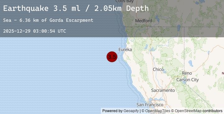
Earthquake 69 km W of Petrolia, CA
Mon, 29 Dec 2025 03:00:54 GMT
Time1 hour ago
Location
40.3930, -125.1002
Depth
2.0 KM
Event Summary
A 3.5 magnitude earthquake struck on 69 km W of Petrolia, CA, at Mon, 29 Dec 2025 03:00:54 GMT. Depth: 2.04999995231628km. Reviewed by USGS seismologists, this minor quake occurred at a magnitude type of ml.
Magnitude
3.5
ml
Source
USGS
Intensity
-
Earthquake Details
AutomaticEvent IDusgs_nc75287946
Tsunami PotentialNo
Magnitude Typeml
Nearest Places
- Gorda Escarpment6.3 km
- Bear Valley31.3 km
- Eel Fan32.7 km
- Mendocino Canyon41.8 km
- Blunts Reef Coast Guard Station51.0 km
Comments
Join the discussion about this event.
Latest Earthquakes
1.1Mag
5 km SE of Loma Linda, CA
Time1 hour ago
Depth17.08 km
SourceUSGS (Automatic)
1.6Mag
2 km NW of The Geysers, CA
Time1 hour ago
Depth3.59 km
SourceUSGS (Automatic)
2.2Mag
CANARY ISLANDS, SPAIN REGION
Time1 hour ago
Depth36.60 km
SourceEMSC (Automatic)
2.6Mag
CENTRAL ITALY
Time1 hour ago
Depth9.00 km
SourceEMSC (Automatic)
4.1Mag
MINDANAO, PHILIPPINES
Time1 hour ago
Depth45.00 km
SourceEMSC (Automatic)
Nearby Earthquakes
No significant earthquakes nearby recently.