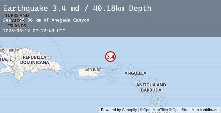
Earthquake 108 km N of Charlotte Amalie, U.S. Virgin Islands
Mon, 12 May 2025 07:12:49 GMT
Time
7 months ago
Location
19.3160, -64.8622
Depth
40.2 KM
Event Summary
A 3.4 magnitude earthquake struck on 108 km N of Charlotte Amalie, U.S. Virgin Islands, at Mon, 12 May 2025 07:12:49 GMT. Depth: 40.18km. Reviewed by USGS seismologists, this minor quake occurred at a magnitude type of md.
Magnitude
3.4
md
Source
USGS
Intensity
-
Earthquake Details
ConfirmedEvent IDusgs_pr71482193
Tsunami PotentialNo
Magnitude Typemd
Nearest Places
- Anegada Canyon25.8 km
- Whale Banks70.6 km
- Amphitheaters Ridge71.6 km
- Turtle Head78.4 km
- Walkover Set Point79.2 km
Comments
Join the discussion about this event.
Latest Earthquakes
2.2Mag
West Papua Region, Indonesia
Time
14 minutes ago
Depth10.00 km
SourceBMKG (Automatic)
3.7Mag
NEAR COAST OF ECUADOR
Time
19 minutes ago
Depth18.00 km
SourceEMSC (Automatic)
3.6Mag
NEAR COAST OF ECUADOR
Time
27 minutes ago
Depth22.00 km
SourceEMSC (Automatic)
2.4Mag
West Papua Region, Indonesia
Time
32 minutes ago
Depth10.00 km
SourceBMKG (Automatic)
2.4Mag
SOUTHERN CALIFORNIA
Time
36 minutes ago
Depth6.90 km
SourceEMSC (Automatic)
Nearby Earthquakes
No significant earthquakes nearby recently.