Earthquake 104 km NNE of Cruz Bay, U.S. Virgin Islands
Tue, 10 Feb 2026 02:35:04 GMT
Time6 hours ago
Location
19.1835, -64.3618
Depth
32.4 KM
Event Summary
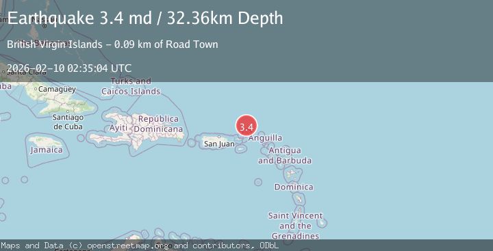
A 3.4 magnitude earthquake struck on 104 km NNE of Cruz Bay, U.S. Virgin Islands, at Tue, 10 Feb 2026 02:35:04 GMT. Depth: 32.36km. Reviewed by USGS seismologists, this minor quake occurred at a magnitude type of md.
Magnitude
3.4
md
Source
USGS
Intensity
-
Agency Reports
1 Sources| Source | Magnitude | Depth | Time |
|---|---|---|---|
| USGSPrimary | 3.4 | 32 km | 6 hours ago |
Earthquake Details
ConfirmedEvent IDusgs_pr71507538
Tsunami PotentialNo
Magnitude Typemd
Nearest Places
- Anegada Canyon31.5 km
- Cow Wreck High Point48.5 km
- Keel Point48.5 km
- Soldier Point48.5 km
- Cow Wreck Bay48.7 km
Comments
Join the discussion about this event.
Latest Earthquakes
1.1Mag
22 km ESE of Chickaloon, Alaska
Time5 hours ago
Depth22.60 km
SourceUSGS (Automatic)
2.0Mag
51 km W of Happy Valley, Alaska
Time5 hours ago
Depth100.30 km
SourceUSGS (Automatic)
1.5Mag
6 km WNW of Cobb, CA
Time5 hours ago
Depth1.82 km
SourceUSGS (Automatic)
2.3Mag
Sulawesi, Indonesia
Time5 hours ago
Depth4.85 km
SourceBMKG
2.2Mag
CENTRAL TURKEY
Time5 hours ago
Depth7.00 km
SourceEMSC (Automatic)
Nearby Earthquakes
3.4Mag
VIRGIN ISLANDS REGION
Time6 hours ago
Depth32.40 km
SourcePR (Automatic)
3.1Mag
VIRGIN ISLANDS REGION
Time1 day ago
Depth35.90 km
SourcePR (Automatic)
4.0Mag
VIRGIN ISLANDS REGION
Time1 day ago
Depth32.00 km
SourcePR (Automatic)
3.9Mag
VIRGIN ISLANDS REGION
Time1 day ago
Depth24.00 km
SourcePR (Automatic)
3.1Mag
VIRGIN ISLANDS REGION
Time15 hours ago
Depth9.90 km
SourcePR (Automatic)